Land cover is raster (pixel) geographic data where each pixel represents a single type of land. Land cover makes it possible to identify and quantify how much of a region (a town, a watershed, a state, etc.) is covered by each land cover class, such as forest, wetlands, impervious surfaces, and agriculture and where. Land cover is different from an aerial or satellite image taken from above. Even those these images may have coordinates and know location, their land cover type can not be easily quantified.
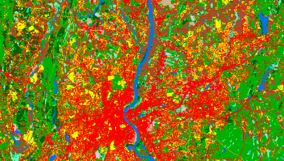
NEW! Changing Landscape with NLCD
Explore the National Land Cover Dataset (NLCD) land cover by HUC12 watershed and local municipality.
- Long Island Sound Watershed
(that's Canada to NY!) - 1985-2023
- 30 meter pixels
- 15 classes
- ability to track change
- includes impervious
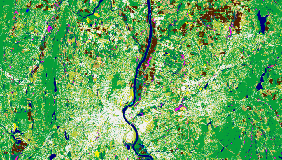
High Resolution Land Cover
High resolution NOAA C-CAP land cover has smaller pixels and therefore greater detail.
- CT
- 2016 with 17 classes
- 2021 with 3, single layers (water, impervious, forest canopy)
- 1 meter pixels
- not able to track change
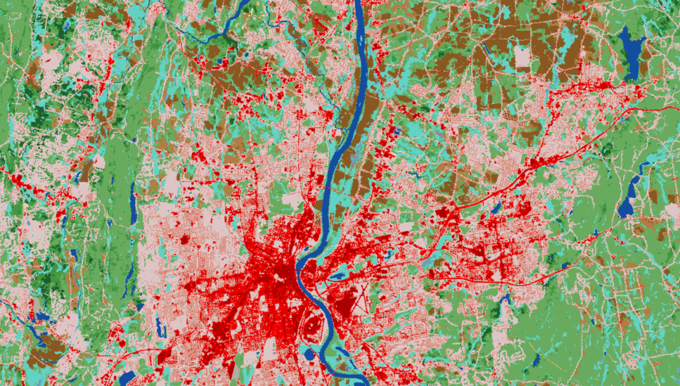
Changing Landscape Original
Original CLEAR land cover created to track change in Connecticut and beyond.
- CT and the lower Long Island Sound Watershed (CT and NY)
- 1985, 1990, 1995, 2002, 2006, 2010, 2015
- 30 meter pixels
- 12 classes
- ability to track change
- includes riparian analysis and forest fragmentation
Factors to Consider when Using Land Cover
Number of Classes
The number of classes in a land cover dataset can very widely, from very few (forest, water, developed, other) to many. For example, one land cover dataset may have a "wetlands" class where another may have 6 wetland classes (palustrine forested wetland, palustrine scrub/shrub wetland, palustrine emergent wetland, estuarine emergent wetland, etc.). Classes can be combined to be broader, but it takes work to make them more specific.
Timing
When was the imagery that was used to create the land cover captured?
The season, especially the difference between summer (leaf-on) imagery and winter (leaf-off) can make a big difference in the land cover.
Also, what years? If you are interested in change detection, how far back does the land cover go and were subsequent dates created in such a way that they can be used for change? Comparing land cover requires the same or similar class and class definitions as well as the same or similar methods so that change identified is real land change and not just a difference in technique.
Error
There is always error associated with the process of converting an image to land cover. Accuracy assessments report the overall error, as well as class-specific errors (commission and omission). Some errors are more problematic than others. For example, mistaking a forest for developed could be a bigger issue than mistaking a wetland for a forested wetland.
Always check for an accuracy assessment before relying on land cover.
Spatial Resolution
Spatial resolution is how much land is covered by one pixel. The smaller the area, the more spatial detail, and the larger the file size.
Although high resolution land cover is fantastic, there are benefits to medium resolution including:
- ability for change analysis since there are older dates,
- ability to seamlessly cover large areas, and
- ease and cost of production.
The changing landscape land cover from both CLEAR and NLCD are medium resolution (30 meter pixels) where the high resolution land cover has 1 meter pixels.
Two types of Land Cover: Medium Resolution and High Resolution
Medium resolution land cover has pixels that cover 30 x 30 meters on the ground, or about 100 feet by 100 feet. CLEAR and CT ECO host several versions of Changing Landscape medium resolution land cover. The Changing Landscape project is a long term, remote sensing-based land cover study that charts landscape changes in Connecticut and beyond for over 30 years, starting in 1985. It also includes subsidiary analyses such as forest fragmentation, riparian area analysis, impervious surface analysis, and more. The availability of satellite imagery starting in 1985 has made it possible for long-term change mapping.
High resolution land cover offers detail in spatial resolution as it has pixels that cover 1 x 1 meter on the ground, or about 3 feet by 3 feet. That is a lot of pixels! Currently there is just one date (2016) of high resolution land with a variety of classes. There is also three single-class land cover datasets from 2021. The three are forest canopy, water, and impervious. The are not a single, 3-class land cover because the areas can overlap (think tree canopy over a road).

Landsat satellite imagery (30 meter pixels)
⇒

Changing Landscape Land Cover (~30 meter/100 foot pixels)

Aerial Imagery (3 inch pixels)
⇒
