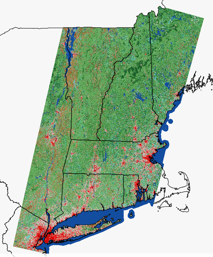
2023 Spring 4 band, 3inch
2023 Spring 4 band, 3inch
Server URL for dynamic image service: https://cteco.uconn.edu/ctraster/rest/services/images/Ortho_2023/ImageServer
Server URL for cached service: https://cteco.uconn.edu/ctraster/rest/services/images/Ortho_2023_tiled/ImageServer
Layer List

2023 Spring Imagery Metadata (xml format) | Download
More about the 2023 flight
2019 Spring 4 band, 6inch
2019 Spring 4 band, 6inch
Server URL for dynamic image service: https://cteco.uconn.edu/ctraster/rest/services/images/Ortho_2019/ImageServer
This service has a stretch applied for better viewing. Change to NIR or remove stretch with raster functions in ArcGIS Online, ArcMap or ArcGIS Pro.
Server URL for cached service: https://cteco.uconn.edu/ctraster/rest/services/images/Ortho_2019_tiled/ImageServer
help: dynamic vs tiled/cached service
Server URL for 4-band dynamic service: https://cteco.uconn.edu/ctraster/rest/services/images/Ortho_2019_orig/ImageServer
This service is the original, 4-band imagery and is best for connecting in a GIS.
Layer List

2019 Spring Imagery Metadata | Download
More about the 2019 flight
2016 Spring 4 band, 3inch
2016 Spring 4 band, 3inch
Server URL for dynamic image service: https://cteco.uconn.edu/ctraster/rest/services/images/Ortho_2016/ImageServer
Server URL for cached image service: https://cteco.uconn.edu/ctraster/rest/services/images/Ortho_2016_tiled/ImageServer
help: dynamic vs tiled/cached service
Layer List

2016 Spring Imagery Metadata | Download
More about the 2016 flight
2012 Spring 4 band, 1ft
2012 Spring 4 band, 1ft
Server URL for dynamic image service: https://cteco.uconn.edu/ctraster/rest/services/images/Ortho_2012/ImageServer
Server URL for cached image service: https://cteco.uconn.edu/ctraster/rest/services/images/Ortho_2012_tiled/ImageServer
Layer List

2012 Spring Imagery Data Guide | Metadata | Download
More about the 2012 flight
2004 Spring, black & white, 1ft
2004 Spring, black & white, 1ft
Server URL (image service): https://cteco.uconn.edu/ctraster/rest/services/images/Ortho_2004/ImageServer
Layer List
2004 Spring Black and White Imagery Data Guide | Metadata
1990 Spring, black & white, 1m
1990 Spring, black & white, 1m
Server URL (image service): https://cteco.uconn.edu/ctraster/rest/services/images/Ortho_1990/ImageServer
Layer List
1990 Spring Black and White Imagery Data Guide | Metadata
2023 NAIP Summer, 4 band, 0.3m
2023 NAIP Summer, 4 band, 0.3m
Server URL (image service): https://cteco.uconn.edu/ctraster/rest/services/images/NAIP_2023/ImageServer
Layer List

2023 NAIP Summer Imagery
Capture dates: The eastern part of the state was captured in September and the western part of the state was captured in late October and November. Visit the USDA NAIP 2023 Connecticut Image Dates for specifics.
For more about NAIP, visit the NAIP Geohub.
2021 NAIP Summer, 4 band, 0.6m
2021 NAIP Summer, 4 band, 0.6m
Server URL (image service): https://cteco.uconn.edu/ctraster/rest/services/images/NAIP_2021/ImageServer
Layer List

2021 NAIP Summer Imagery
Capture dates: The eastern part of the state was captured in September and the western part of the state was captured in late October and November. Visit the USDA NAIP 2021 Connecticut Image Dates service for specifics.
For more about NAIP, visit the NAIP Geohub.
2018 NAIP Summer, 4 band, 0.6m
2018 NAIP Summer, 4 band, 0.6m
Server URL (image service): https://cteco.uconn.edu/ctraster/rest/services/images/NAIP_2018/ImageServer
Layer List

2018 NAIP Summer Imagery Metadata (txt file)
2016 NAIP Summer, 4 band, 0.6m
2016 NAIP Summer, 4 band, 0.6m
Server URL (image service): https://cteco.uconn.edu/ctraster/rest/services/images/NAIP_2016/ImageServer
Layer List

2016 NAIP Summer Imagery Metadata (txt file)
2014 NAIP Summer, 4 band, 1m
2014 NAIP Summer, 4 band, 1m
Server URL (image service): https://cteco.uconn.edu/ctraster/rest/services/images/NAIP_2014/ImageServer
Layer List

2014 NAIP Summer Imagery Metadata (txt file)
2012 NAIP Summer, 4 band, 1m
2012 NAIP Summer, 4 band, 1m
Server URL (image service): https://cteco.uconn.edu/ctraster/rest/services/images/NAIP_2012/ImageServer
Layer List

2012 NAIP Summer Imagery Data Guide | Metadata (txt file)
2010 NAIP Summer, 4 band, 1m
2010 NAIP Summer, 4 band, 1m
Server URL (image service): https://cteco.uconn.edu/ctraster/rest/services/images/NAIP_2010/ImageServer
Layer List

2010 NAIP Summer Imagery Data Guide | Metadata
2008 NAIP Summer, 4 band, 1m
2008 NAIP Summer, 4 band, 1m
Server URL (image service): https://cteco.uconn.edu/ctraster/rest/services/images/NAIP_2008/ImageServer
Layer List

2008 NAIP Summer Imagery Data Guide | Metadata
2006 NAIP Summer Imagery, 3 band, 1m
2006 NAIP Summer Imagery, 3 band, 1m
Server URL (image service): https://cteco.uconn.edu/ctraster/rest/services/images/NAIP_2006/ImageServer
Layer List
2006 NAIP Summer Imagery Data Guide | Metadata
1934 Scanned Aerial Photography Mosaic
1934 Scanned Aerial Photography Mosaic
Server URL (image service): https://cteco.uconn.edu/ctraster/rest/services/images/Mosaic_1934_MAGIC/ImageServer
Layer List
1934 Scanned Aerial Photography Mosaic More Info
2017 Eastern Coast, 4 band, 1ft
2017 Eastern Coast, 4 band, 1ft
Server URL (image service): http://cteco.uconn.edu/ctraster/rest/services/images/Ortho_2017_E_CTCoast/ImageServer
Layer List

2016 Coastal Summer, 4 band, 6inch
2016 Coastal Summer, 4 band, 6inch
Server URL (image service): https://cteco.uconn.edu/ctraster/rest/services/images/Ortho_2016_Coast/ImageServer
Layer List

2016 Coastal Summer Aerial Imagery Data Guide | Metadata
2010 Coastal Summer, 4 band, 1ft
2010 Coastal Summer, 4 band, 1ft
Server URL (image service): https://cteco.uconn.edu/ctraster/rest/services/images/Ortho_2010_Coast/ImageServer
Layer List

2010 Coastal Summer Aerial Imagery Data Guide | Metadata
2005 Coastal Summer Infrared, 3 band, 1ft
2005 Coastal Summer Infrared, 3 band, 1ft
Server URL (image service): https://cteco.uconn.edu/ctraster/rest/services/images/Ortho_2005_Coast_IR/ImageServer
Layer List
2005 Coastal Summer Infrared Imagery Data Guide | Metadata
2004 Coastal Summer, 4 band, 0.5m
2004 Coastal Summer, 4 band, 0.5m
Server URL (image service): Color https://cteco.uconn.edu/ctraster/rest/services/images/Ortho_2004_Coast_Color/ImageServer
Server URL (image service): Infrared https://cteco.uconn.edu/ctraster/rest/services/images/Ortho_2004_Coast_IR/ImageServer
Layer List

2004 Coastal Summer Imagery Data Guide | Color Metadata | Infrared Metadata
2004 Coastal Summer Infrared, 3 band, 0.5m
2004 Coastal Summer Infrared, 3 band, 0.5m
Server URL (image service): https://cteco.uconn.edu/ctraster/rest/services/images/Ortho_2004_Coast_IR/ImageServer
Layer List
2004 Coastal Summer Infrared Imagery Data Guide | Metadata
2009 CRCOG Spring, color, 3″
2009 CRCOG Spring, color, 3"
Server URL: https://cteco.uconn.edu/ctraster/rest/services/images/Ortho_2009_CRCOG/ImageServer
Layer List
2009 CRCOG Spring Aerial Imagery Data Guide | Metadata
2008 Urban Area, Spring, color, 1ft
2008 Urban Area, Spring, color, 1ft
Server URL: https://cteco.uconn.edu/ctraster/rest/services/images/Ortho_2008_UrbanArea/ImageServer
Layer List
2008 Urban Area Spring Aerial Imagery Data Guide | Metadata
Aspect (from Statewide 2023 DEM)
Aspect (Statewide 2023)
Server URL (image service): https://cteco.uconn.edu/ctraster/rest/services/elevation/Aspect/ImageServer
Layer List
Aspect DEM Metadata xml
Elevation Explained
Under the Hood - Aspect
More about the 2023 flight
Hillshade (from Statewide 2023 DEM)
Hillshade (Statewide 2023)
Server URL (image service): https://cteco.uconn.edu/ctraster/rest/services/elevation/Hillshade/ImageServer
Layer List
Hillshade DEM Metadata xml
Elevation Explained
Under the Hood - Hillshade
Apply Raster Functions to Change Hillshade Illumination
More about the 2023 flight
Intensity (from Statewide 2023 Lidar)
Intensity (Statewide 2023)
Server URL (image service): https://cteco.uconn.edu/ctraster/rest/services/elevation/Intensity2023/ImageServer
Layer List
Intensity2023 Classified Point Cloud Metadata xml
More about the 2023 flight
Shaded Relief (from Statewide 2023 DEM)
Shaded Relief (Statewide 2023)
Server URL (image service): https://cteco.uconn.edu/ctraster/rest/services/elevation/ShadedRelief/ImageServer
Layer List
Shaded Relief DEM Metadata xml
Elevation Explained
Under the Hood - Shaded Relief
More about the 2023 flight
Shaded Relief without Adjustment (from Statewide 2023 DEM)
Shaded Relief no Adjustment (Statewide 2023)
Server URL (image service): https://cteco.uconn.edu/ctraster/rest/services/elevation/ShadedRelief_noDRA/ImageServer
Layer List
Shaded Relief (no adjustment) DEM Metadata xml
Elevation Explained
Under the Hood - Shaded Relief
More about the 2023 flight
Slope (from Statewide 2023 DEM)
Slope (Statewide 2023)
Server URL (image service): https://cteco.uconn.edu/ctraster/rest/services/elevation/Slope/ImageServer
Layer List
Elevation Explained
Under the Hood - Slope
More about the 2023 flight
Elevation (Statewide 2023 DEM)
Elevation (Statewide 2023)
Server URL (image service): https://cteco.uconn.edu/ctraster/rest/services/elevation/Elevation/ImageServer
Server URL for use with raster functions (image service): https://cteco.uconn.edu/ctraster/rest/services/elevation/Statewide2023/ImageServer
Layer List
Elevation Metadata xml | Download (use download tool)
More about the 2023 flight
Contours (2023)
Contours (2023)
Server URL (vector tile service): https://tiles.arcgis.com/tiles/3FL1kr7L4LvwA2Kb/arcgis/rest/services/connecticut_contours/VectorTileServer

Layer List
Contours (2016)
Contours (2016)
Server URL (map service): https://cteco.uconn.edu/ctmaps/rest/services/Elevation/Contours_2016_tiled/MapServer
Layer List
2016 Contours Metadata (2016 Lidar)
Statewide, 1 foot contours created from the 2016 Lidar are served as a tiled service and a dynamic service with labels. The tiled service is signficantly faster.
Elevation (Statewide 2016 DEM)
Elevation (Statewide 2016)
Server URL (image service): https://cteco.uconn.edu/ctraster/rest/services/elevation/Elevation/ImageServer
Server URL for use with raster functions (image service): https://cteco.uconn.edu/ctraster/rest/services/elevation/Statewide2016/ImageServer
Layer List
More about the 2016 flight
Central Connecticut DEM 2014
Central Connecticut Elevation 2014
Server URL (image service): https://cteco.uconn.edu/ctraster/rest/services/elevation/Central2014/ImageServer
Layer List
Central 2014 More Information
Raster functions available to apply hillshade, shaded relief, slope and aspect to the DEM.
Coastal Connecticut 2012
Coastal Connecticut Elevation 2012
Server URL (image server): https://cteco.uconn.edu/ctraster/rest/services/elevation/Coast2012/ImageServer
Layer List
Coastal 2012 More Information
Raster functions available to apply hillshade, shaded relief, slope and aspect to the DEM.
Northwest Connecticut DEM 2011
Northwest Connecticut Elevation 2011
Server URL (image server): https://cteco.uconn.edu/ctraster/rest/services/elevation/Northwest2011/ImageServer
Layer List
Northwest 2011 More Information
Raster functions available to apply hillshade, shaded relief, slope and aspect to the DEM.
Northeast Connecticut DEM 2010
Eastern Connecticut Elevation 2010
Server URL (image server): https://cteco.uconn.edu/ctraster/rest/services/elevation/East2010/ImageServer
Layer List
East 2010 More Information
Raster functions available to apply hillshade, shaded relief, slope and aspect to the DEM.
Southwest Connecticut Elevation 2011
Southwest Connecticut Elevation 2011
Server URL (image service): https://cteco.uconn.edu/ctraster/rest/services/elevation/Southwest2011/ImageServer
Layer List
Southwest 2011 More Information
Raster functions available to apply hillshade, shaded relief, slope and aspect to the DEM.
Southeast Connecticut Elevation 2011
Southeast Connecticut Elevation 2011
Server URL (image service): https://cteco.uconn.edu/ctraster/rest/services/elevation/Southeast2011/ImageServer
Layer List
Southeast 2011 More Information
Raster functions available to apply hillshade, shaded relief, slope and aspect to the DEM.
Contours (2000)
Contours (2000)
Server URL (map service): https://cteco.uconn.edu/ctmaps/rest/services/Elevation/CT_Contours_2000/MapServer
Layer List
Contours (2000) Data Guide
Topobathy Lidar: Long Island Sound
Topobathy Lidar 2023: Long Island Sound
Server URL (image service): https://cteco.uconn.edu/ctraster/rest/services/elevation/LIS_topobathy2023/ImageServer
Layer List
LIS_topobathy2023 Metadata | Data Report
Lake Bathymetry
Lake Bathymetry
DEEP Server URLs (feature service): https://services1.arcgis.com/FjPcSmEFuDYlIdKC/ArcGIS/rest/services/Lake_Bathymetry_Contours/FeatureServer
Old Server URL (map service): https://cteco.uconn.edu/ctmaps/rest/services/Elevation/Lake_Bathymetry/MapServer
Layer List
Lake Bathymetry Data Guide
Lake Bathymetry Contours (2000) Metadata
Lake Bathymetry Poly Metadata
Base Map (Connecticut)
Base Map (Connecticut)
![]() This service is retired. Please add individual layers to create a base map.
This service is retired. Please add individual layers to create a base map.
Server URL (map service): https://cteco.uconn.edu/ctmaps/rest/services/Base_Map/CT_Base_Map/MapServer
Layer List
- Geographic Names Metadata
- Geographic Place Name Metadata
- Airport Metadata
- Railroad Metadata
- Routes and Streets Data Guide | Metadata
- County Metadata
- Town Metadata
- State Line
- Waterbodies Metadata
- Hydrography
Base Map (Bordering States)
Base Map (Bordering States)
DEEP Server URL (feature service): https://services1.arcgis.com/FjPcSmEFuDYlIdKC/arcgis/rest/services/Northeastern_States_State_Boundary_Set/FeatureServer
![]() RETIRED. Old Server URL (map service): https://cteco.uconn.edu/ctmaps/rest/services/Base_Map/CT_Bordering_States/MapServer
RETIRED. Old Server URL (map service): https://cteco.uconn.edu/ctmaps/rest/services/Base_Map/CT_Bordering_States/MapServer
Layer List
- Town (MA, NY, RI) Metadata
- Connecticut Vicinity State Lines (MA, NY, RI)
Critical Habitat
Critical Habitat
DEEP Server URL (feature service): https://services1.arcgis.com/FjPcSmEFuDYlIdKC/ArcGIS/rest/services/Critical_Habitats/FeatureServer
![]() RETIRED. Old Server URL (map service): https://cteco.uconn.edu/ctmaps/rest/services/Bioscience/Critical_Habitat/MapServer
RETIRED. Old Server URL (map service): https://cteco.uconn.edu/ctmaps/rest/services/Bioscience/Critical_Habitat/MapServer
Layer List
Critical Habitats Data Guide | Resource Guide | Metadata
National Wetlands Inventory (NWI) Wetlands Functions 2010
National Wetlands Inventory (NWI) Wetlands Functions
DEEP Server URL (feature service): https://services1.arcgis.com/FjPcSmEFuDYlIdKC/ArcGIS/rest/services/Connecticut_NWI_Wetlands_2024/FeatureServer
![]() RETIRED. Old CT ECO Server URL (map service): https://cteco.uconn.edu/ctmaps/rest/services/Bioscience/CT_NWI_Wetland_Functions_2010/MapServer
RETIRED. Old CT ECO Server URL (map service): https://cteco.uconn.edu/ctmaps/rest/services/Bioscience/CT_NWI_Wetland_Functions_2010/MapServer
DEEP Layer List
Connecticut NWI Wetlands 2024
US Fish and Wildlife Wetland Services | US Fish and Wildlife Wetland Data Download
The US Fish and Wildlife Service also provides both a raster service and vector service that cover the continental US.
Old CT ECO Layer List
- Freshwater Forest and Shrub Wetlands
- Freshwater Emergent Wetland
- Other Freshwater Wetland
- Estuarine and Marine Wetlands
- Estuarine and Marine Deep Water
- Freshwater Ponds
- Lakes
- Riverine
- CT NWI Explained
Natural Diversity Database
Natural Diversity Database
DEEP Server URL (feature service): https://services1.arcgis.com/FjPcSmEFuDYlIdKC/arcgis/rest/services/Natural_Diversity_Database/FeatureServer
![]() RETIRED. Old (as of June 2021) Server URL: https://cteco.uconn.edu/ctmaps/rest/services/Bioscience/Natural_Diversity_Database_Areas/MapServer
RETIRED. Old (as of June 2021) Server URL: https://cteco.uconn.edu/ctmaps/rest/services/Bioscience/Natural_Diversity_Database_Areas/MapServer

Layer List
Natural Diversity Database Data Guide | Resource Guide | Metadata
Tidal Wetlands 1970s
Tidal Wetlands 1970s
DEEP Server URL (feature service): https://services1.arcgis.com/FjPcSmEFuDYlIdKC/ArcGIS/rest/services/Tidal_Wetlands_1970s/FeatureServer
![]() RETIRED. Old Server URL: https://cteco.uconn.edu/ctmaps/rest/services/Bioscience/Tidal_Wetlands_1970s/MapServer
RETIRED. Old Server URL: https://cteco.uconn.edu/ctmaps/rest/services/Bioscience/Tidal_Wetlands_1970s/MapServer
Layer List
Tidal Wetlands 1970s Metadata
Tidal Wetlands 1990s
Tidal Wetlands 1990s
DEEP Server URL (feature service): https://services1.arcgis.com/FjPcSmEFuDYlIdKC/ArcGIS/rest/services/Tidal_Wetlands_1990s/FeatureServer/0
![]() RETIRED. Old Server URL: https://cteco.uconn.edu/ctmaps/rest/services/Bioscience/Tidal_Wetlands_1990s/MapServer
RETIRED. Old Server URL: https://cteco.uconn.edu/ctmaps/rest/services/Bioscience/Tidal_Wetlands_1990s/MapServer
Layer List
Tidal Wetlands 1990s Metadata
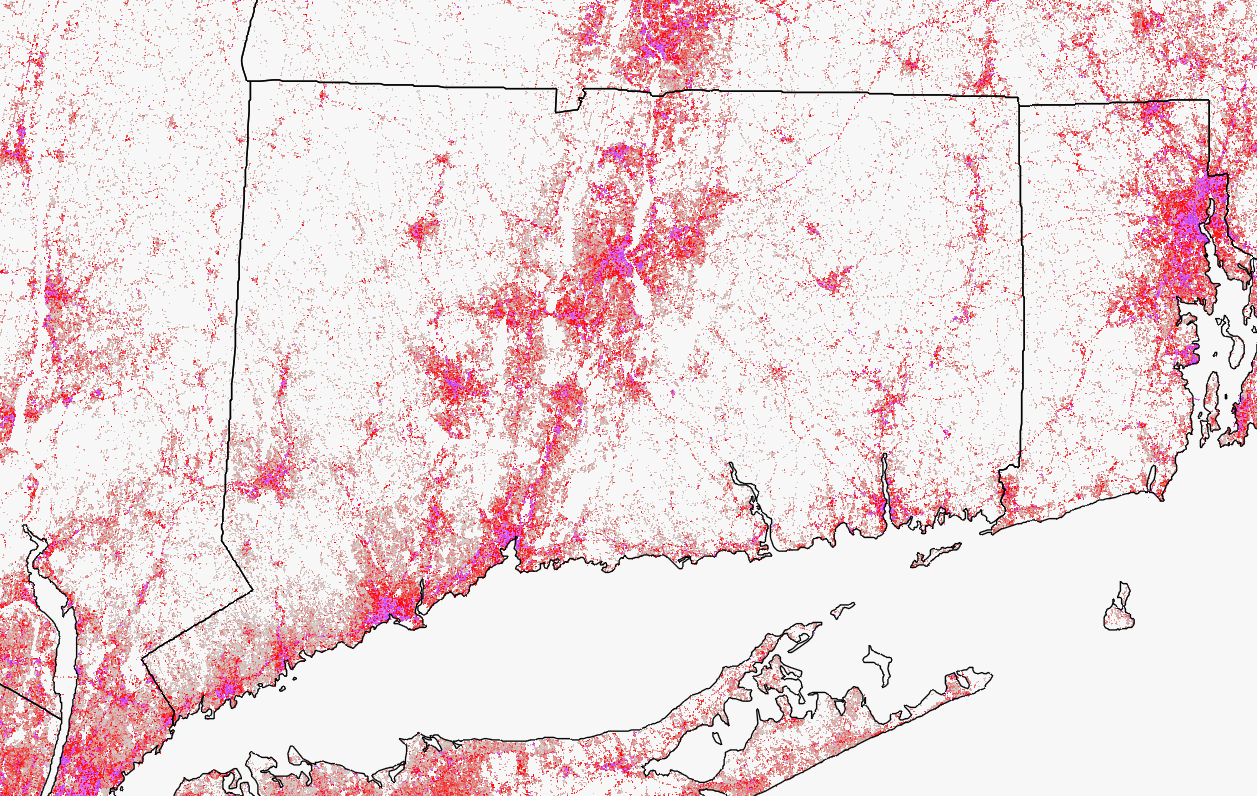
2012 Impervious Cover
Impervious Surface 2012
Server URL (map service): https://cteco.uconn.edu/ctmaps/rest/services/Impervious/Impervious_2012_StatePlane/MapServer
Layer List
2012 Impervious Surface CT State Plane
Impervious Surface 2012 CT State Plane
Server URL (map service): https://cteco.uconn.edu/ctmaps/rest/services/Impervious/Impervious_2012_StatePlane/MapServer
Layer List
2012 Impervious Surface Simplified Vector CT State Plane
Impervious Surface 2012 Simplified Vector CT State Plane
Server URL (map service): https://cteco.uconn.edu/ctmaps/rest/services/Impervious/Impevious2012_simplified_vector_StatePlane/MapServer
Layer List
Impervious 2012 Simplified Vector (State Plane) Metadata | Download
Includes road surface, buildings and other impervious.
2012 Impervious Cover by Basin and Town
2012 Impervious Cover by Town and Basin
Server URL (map service): https://cteco.uconn.edu/ctmaps/rest/services/MS4/MS4_Layers/MapServer
Layer List


Impervious Cover by Basin Data Guide
Impervious Cover by Town
The attribute table includes total impervious area and percentages as well as area and percentage each for each class of buildings, roads and other impervious.
More about MS4
MS4 2016 Impaired Waters
2016 MS4 Impaired Waters
Server URL (map service): https://cteco.uconn.edu/ctmaps/rest/services/MS4/MS4_Layers/MapServer
Layer List
CT 2016 MS4 Impaired Rivers Data Guide | Metadata | Download | Layer Link
CT 2016 MS4 Impaired Lakes Data Guide | Metadata | Download | Layer Link
CT 2016 MS4 Impaired Estuaries Data Guide | Metadata | Download | Layer Link
Contains rivers, lakes and streams included in the Connecticut Integrated Water Quality report as being impaired for stormwater runoff related causes.
More about MS4
MS4 2018 Impaired Waters
2018 MS4 Impaired Waters
Server URL: https://cteco.uconn.edu/ctmaps/rest/services/MS4/MS4_Layers/MapServer
Layer List
CT 2018 MS4 Impaired Rivers Data Guide | Metadata | Download | Layer Link
CT 2018 MS4 Impaired Lakes Data Guide | Metadata | Download | Layer Link
CT 2018 MS4 Impaired Estuaries Data Guide | Metadata | Download | Layer Link
Contains rivers, lakes and streams included in the Connecticut Integrated Water Quality report as being impaired for stormwater runoff related causes.
More about MS4
MS4 2020 Impaired Waters
2020 MS4 Impaired Waters
Server URL (map service): https://cteco.uconn.edu/ctmaps/rest/services/MS4/MS4_Layers/MapServer
Layer List
CT 2020 MS4 Impaired Rivers Data Guide | Metadata | Download | Layer Link
CT 2020 MS4 Impaired Lakes Data Guide | Metadata | Download | Layer Link
CT 2020 MS4 Impaired Estuaries Data Guide | Metadata | Download | Layer Link
Contains rivers, lakes and streams included in the Connecticut Integrated Water Quality report as being impaired for stormwater runoff related causes.
More about MS4
Urbanized Area
Urbanized Area
Server URL (map service): https://cteco.uconn.edu/ctmaps/rest/services/MS4/MS4_Layers/MapServer
Layer List
Urbanized Area
Councils of Governments
Councils of Governments
Server URL (map service): https://cteco.uconn.edu/ctmaps/rest/services/MS4/MS4_Layers/MapServer
Layer List
Councils of Government
MS4 Towns
MS4 Towns
Server URL (map service): https://cteco.uconn.edu/ctmaps/rest/services/MS4/MS4_Layers/MapServer
Layer List
MS4 Towns
More about MS4
Coastal Management Area
Coastal Management
DEEP Server URL (feature service): https://services1.arcgis.com/FjPcSmEFuDYlIdKC/arcgis/rest/services/Coastal_Area_Boundary_Polygon/FeatureServer
![]() RETIRED. Old Server URL (map service): https://cteco.uconn.edu/ctmaps/rest/services/Coastal/CT_Coastal_Managment_Areas/MapServer
RETIRED. Old Server URL (map service): https://cteco.uconn.edu/ctmaps/rest/services/Coastal/CT_Coastal_Managment_Areas/MapServer
Layer List
Eelgrass Beds 2002-2012
Eelgrass Beds 2002-2012
DEEP Server URLs (feature service)
- 2002: https://services1.arcgis.com/FjPcSmEFuDYlIdKC/arcgis/rest/services/Eelgrass_2002_Points_Beds/FeatureServer
- 2006: https://services1.arcgis.com/FjPcSmEFuDYlIdKC/arcgis/rest/services/Eelgrass_2006_Points_Beds/FeatureServer
- 2009: https://services1.arcgis.com/FjPcSmEFuDYlIdKC/arcgis/rest/services/Eelgrass_2009_Points_Beds/FeatureServer
- 2012: https://services1.arcgis.com/FjPcSmEFuDYlIdKC/arcgis/rest/services/Connecticut_Eelgrass_Beds_2012_Polygon/FeatureServer/0
![]() RETIRED. Old Server URL (map service): https://cteco.uconn.edu/ctmaps/rest/services/Coastal/Eelgrass_Beds_2002_2012/MapServer
RETIRED. Old Server URL (map service): https://cteco.uconn.edu/ctmaps/rest/services/Coastal/Eelgrass_Beds_2002_2012/MapServer
Layer List
Eelgrass Beds 2002 CT DEEP Open GIS Data Summary | Field Data Metadata | Polygon Metadata
Eelgrass Beds 2006 CT DEEP Open GIS Data Summary | Field Data Metadata | Polygon Metadata
Eelgrass Beds 2009 CT DEEP Open GIS Data Summary | Field Data Metadata | Polygon Metadata
Eelgrass Beds 2012 CT DEEP Open GIS Data Summary | Polygon Metadata
CT Hurricane Evacuation Zones 2014
CT Hurricane Evacuation Zones 2014
DEEP Server URL (feature service): https://services1.arcgis.com/FjPcSmEFuDYlIdKC/arcgis/rest/services/Hurricane_Evacuation_Zones_2014/FeatureServer/0
![]() RETIRED. Old Server URL (map service): https://cteco.uconn.edu/ctmaps/rest/services/Coastal/CT_Hurricane_Evacuation_Zones_2014/MapServer
RETIRED. Old Server URL (map service): https://cteco.uconn.edu/ctmaps/rest/services/Coastal/CT_Hurricane_Evacuation_Zones_2014/MapServer
Layer List
Hurricane Evacuation Zones 2014 Metadata
Hurricane Surge Inundation 2012
Hurricane Surge Inundation 2012
CT DEEP Server URL (feature service): https://services1.arcgis.com/FjPcSmEFuDYlIdKC/arcgis/rest/services/CT_Hurricane_Surge_Inundation/FeatureServer/0
![]() RETIRED. Old CT ECO Server URL (map service): https://cteco.uconn.edu/ctmaps/rest/services/Coastal/CT_Hurricane_Surge_Inundation_2012/MapServer
RETIRED. Old CT ECO Server URL (map service): https://cteco.uconn.edu/ctmaps/rest/services/Coastal/CT_Hurricane_Surge_Inundation_2012/MapServer
Layer List
Hurricane Surge Inundation Data Guide | Resource Guide | Metadata
Long Island Sound Environmental Observation
Long Island Sound Environmental Observation
DEEP Server URL (feature service): https://services1.arcgis.com/FjPcSmEFuDYlIdKC/arcgis/rest/services/LIS_Environmental_Observation/FeatureServer/0
![]() RETIRED. Old Server URL (map service): https://cteco.uconn.edu/ctmaps/rest/services/Coastal/LIS_Environmental_Observation/MapServer
RETIRED. Old Server URL (map service): https://cteco.uconn.edu/ctmaps/rest/services/Coastal/LIS_Environmental_Observation/MapServer
Layer List
Long Island Sound Observation Locations More Info
Sea Level Rise
Sea Level Rise
Average Monthly Maximum Inundation Server URL (map service):
https://cteco.uconn.edu/ctmaps/rest/services/Coastal/Sea_Level_Rise_Average_Monthly_Maximum/MapServer
Mean High Water Server URL (map service): https://cteco.uconn.edu/ctmaps/rest/services/Coastal/Sea_Level_Rise_Mean_High_Water/MapServer
Layer List
Average Monthly Maximum Inundation
- Average Monthly Maximum Inundation
- Average Monthly Maximum Inundation (+ 6 in)
- Average Monthly Maximum Inundation (+ 12 in)
- Average Monthly Maximum Inundation (+ 18 in)
- Average Monthly Maximum Inundation (+ 24 in)
- Average Monthly Maximum Inundation (+ 36 in)
- Average Monthly Maximum Inundation (+ 60 in)
- Average Monthly Maximum Inundation (+ 79 in)
 Mean High Water Scenarios
- Mean High Water Inundation
- Mean High Water Inundation (+ 6 in)
- Mean High Water Inundation (+ 12 in)
- Mean High Water Inundation (+ 18 in)
- Mean High Water Inundation (+ 24 in)
- Mean High Water Inundation (+ 36 in)
- Mean High Water Inundation (+ 60 in)
- Mean High Water Inundation (+ 79 in)
Shoreline Change
Shoreline Change
Short Term Shoreline Change DEEP Server URL (feature service) https://services1.arcgis.com/FjPcSmEFuDYlIdKC/arcgis/rest/services/Shoreline_Change_Short_Term/FeatureServer
Long Term Shoreline Change DEEP Server URL (feature service) https://services1.arcgis.com/FjPcSmEFuDYlIdKC/arcgis/rest/services/Long_Term_Change/FeatureServer
Shoreline Change Supplemental Data Server URL (feature service) https://services1.arcgis.com/FjPcSmEFuDYlIdKC/ArcGIS/rest/services/Shoreline_Change_Supplemental_Data/FeatureServer
![]() RETIRED. Short Term Shoreline Change Server URL (map service): https://cteco.uconn.edu/ctmaps/rest/services/Coastal/Shoreline_Change_Short_Term/MapServer
RETIRED. Short Term Shoreline Change Server URL (map service): https://cteco.uconn.edu/ctmaps/rest/services/Coastal/Shoreline_Change_Short_Term/MapServer
![]() RETIRED. Long Term Shoreline Change Server URL (map service): https://cteco.uconn.edu/ctmaps/rest/services/Coastal/Shoreline_Change_Long_Term/MapServer
RETIRED. Long Term Shoreline Change Server URL (map service): https://cteco.uconn.edu/ctmaps/rest/services/Coastal/Shoreline_Change_Long_Term/MapServer
Layer List
Short Term Shoreline Change
- Positive Net Shoreline Movement (meters)
- Negative Net Shoreline Movement (meters)
- Positive End Point Rates (meters/year)
- Negative End Point Rates (meters/year)
- Shoreline Change Transects 1983-2006
- CT Shorelines: 1983-2006
Long Term Shoreline Change
- Positive Net Shoreline Movement (meters)
- Negative Net Shoreline Movement (meters)
- Positive End Point Rates (meters/year)
- Negative End Point Rates (meters/year)
- Positive Linear Regression Rates (meters/year)
- Negative Linear Regression Rates (meters/year)
- Shoreline Change Transects 1880-2006
- CT Shorelines: 1880s-2006
Shoreline Change Supplemental Data
- Reduced Transect Counts for Regional Averaging
- Offshore Baselines
Old Layer List
Short Term Change
- Shoreline Change Transects 1983-2006
- Net Shoreline Movement (NSM) 1983-2006
- Positive Net Shoreline Movement (meters)
- Negative Net Shoreline Movement (meters)
- End Point Rates (EPR) 1983-2006
- Postive End Point Rates (meters/year)
- Negative End Point Rates (meters/year)
- CT Shorelines: 1983-2006
 Long Term Change
- Shoreline Change Transects 1880-2006
- Net Shoreline Movement (NSM) 1880-2006
- Positive Net Shoreline Movement (meters)
- Negative Net Shoreline Movement (meters)
- End Point Rates (EPR) 1880-2006
- Positive End Point Rates (meters/year)
- Negative End Point Rates (meters/year)
- Linear Regression Rates (LRR) 1880-2006
- Positive Linear Regression Rates (meters/year)
- Negative Linear Regression Rates (meters/year)
- CT Shorelines: 1880s-2006
Storm Sandy
Storm Sandy
Damage Assessments Server URL (map service): https://cteco.uconn.edu/ctmaps/rest/services/Coastal/TS_Sandy_Damage_Assessments/MapServer
Impact Analysis Server URL (map service): https://cteco.uconn.edu/ctmaps/rest/services/Coastal/TS_Sandy_Impact_Analysis/MapServer
Surge Data Server URL (map service): https://cteco.uconn.edu/ctmaps/rest/services/Coastal/TS_Sandy_Surge_Data/MapServer
Water Level URL (map service): https://cteco.uconn.edu/ctmaps/rest/services/Coastal/TS_Sandy_Water_Level/MapServer
Wind Data URL (map service): https://cteco.uconn.edu/ctmaps/rest/services/Coastal/TS_Sandy_Wind_Data/MapServer
Layer List
Damage Assessments

- v16_2012_11_06_1600EST
- v17_2012_11_07_1320EST
- v18_2012_11_08_1940EST
- v19_2012_11_09_1715EST
- v20_2012_11_10_1800EST
- v21_2012_11_12_1600EST
- v22_2012_11_13_1340EST
- v23_2012_11_14_1250EST
- v26_2012_11_19_2000EST
- v27_2012_11_21_2000EST
Impact Analysis

- Hurricane Sandy Impacts Analysis - 11-26-12
- Hurricane Sandy Impact Analysis - 11-06-12
Surge Data

- Hi-Res Surge
- Water Surface Elevations
Water Level

- Peak Locations
- USGS High Water Marks
- Storm Sensor Network
Wind Data

- AL182012- H* Wind Analysis-MaxSpeed
- AL182012- H* Wind Analysis-MaxDirection
- AL182012_1028_0130
- AL182012_1029_0130
- AL182012_1029_0430
- AL182012_1029_0730
- AL182012_1029_1030
- AL182012_1029_1330
- AL182012_1029_1502
- AL182012_1029_1630
- AL182012_1029_1930
- AL182012_1029_2230
- AL182012_1030_0130
- AL182012_1030_0430
- AL182012_1030_0730
Bedrock
Bedrock Geology
DEEP Server URL (feature service): https://services1.arcgis.com/FjPcSmEFuDYlIdKC/ArcGIS/rest/services/Connecticut_Bedrock_Geology/FeatureServer
![]() RETIRED. Old CT ECO Server URL (map service): https://cteco.uconn.edu/ctmaps/rest/services/Geology/Bedrock/MapServer
RETIRED. Old CT ECO Server URL (map service): https://cteco.uconn.edu/ctmaps/rest/services/Geology/Bedrock/MapServer
Layer List
Bedrock Geology Contacts Metadata
Bedrock Geology Metadata
Bedrock Terrane
Bedrock Terrane
DEEP Server URL (feature service): https://services1.arcgis.com/FjPcSmEFuDYlIdKC/arcgis/rest/services/Bedrock_Terrane/FeatureServer
![]() RETIRED. Old Server URL (map service): https://cteco.uconn.edu/ctmaps/rest/services/Geology/Bedrock_Terrane/MapServer
RETIRED. Old Server URL (map service): https://cteco.uconn.edu/ctmaps/rest/services/Geology/Bedrock_Terrane/MapServer
Layer List
Bedrock Terrane Contacts Metadata
Bedrock Terrane Metadata
Erosion Susceptibility
Erosion Susceptibility
DEEP Server URL (feature service): https://services1.arcgis.com/FjPcSmEFuDYlIdKC/ArcGIS/rest/services/Erosion_Susceptibility_Set/FeatureServer
![]() RETIRED. Old CT ECO Server URL (map service): https://cteco.uconn.edu/ctmaps/rest/services/Geology/Erosion_Susceptibility/MapServer
RETIRED. Old CT ECO Server URL (map service): https://cteco.uconn.edu/ctmaps/rest/services/Geology/Erosion_Susceptibility/MapServer
Layer List
Erosion Susceptibility Sites Metadata
Erosion Susceptibility Data Guide | Metadata
Quaternary Geology
Quaternary Geology
DEEP Server URL (feature service): https://services1.arcgis.com/FjPcSmEFuDYlIdKC/ArcGIS/rest/services/Connecticut_Quaternary_Geology_Features/FeatureServer
![]() RETIRED. Old CT ECO Server URL (map service): https://cteco.uconn.edu/ctmaps/rest/services/Geology/Quaternary_Geology/MapServer
RETIRED. Old CT ECO Server URL (map service): https://cteco.uconn.edu/ctmaps/rest/services/Geology/Quaternary_Geology/MapServer
Layer List
Quaternary Geology Data Guide | Resource Guide
- Quaternary Geology Point Features Metadata
- Quaternary Geology Line Features Metadata
- Quaternary Geology Overlays
- Quaternary Geology Deposits
Long Island Sound Quaternary Geology
Surficial Aquifer Potential
Surficial Aquifer Potential
DEEP Server URL (feature service): https://services1.arcgis.com/FjPcSmEFuDYlIdKC/ArcGIS/rest/services/Connecticut_Surficial_Aquifer_Potential/FeatureServer
![]() RETIRED. Old CT ECO Server URL (map service): https://cteco.uconn.edu/ctmaps/rest/services/Geology/Surficial_Aquifer_Potential/MapServer
RETIRED. Old CT ECO Server URL (map service): https://cteco.uconn.edu/ctmaps/rest/services/Geology/Surficial_Aquifer_Potential/MapServer
Layer List
Surficial Aquifer Potential Metadata
Surficial Aquifer Texture
Surficial Aquifer Texture
DEEP Server URL (feature service): https://services1.arcgis.com/FjPcSmEFuDYlIdKC/ArcGIS/rest/services/Connecticut_Surficial_Aquifer_Texture/FeatureServer
![]() RETIRED. Old CT ECO Server URL (map service): https://cteco.uconn.edu/ctmaps/rest/services/Geology/Surficial_Aquifer_Texture/MapServer
RETIRED. Old CT ECO Server URL (map service): https://cteco.uconn.edu/ctmaps/rest/services/Geology/Surficial_Aquifer_Texture/MapServer
Layer List
Surficial Aquifer Texture Metadata
Surficial Materials
Surficial Materials
DEEP Server URL (feature service): https://services1.arcgis.com/FjPcSmEFuDYlIdKC/ArcGIS/rest/services/Surficial_Materials_Set/FeatureServer
![]() RETIRED. Old CT ECO Server URL (map service): https://cteco.uconn.edu/ctmaps/rest/services/Geology/Surficial_Materials/MapServer
RETIRED. Old CT ECO Server URL (map service): https://cteco.uconn.edu/ctmaps/rest/services/Geology/Surficial_Materials/MapServer
Layer List
Surficial Materials Data Guide | Resource Guide | Metadata
Hydrography
Hydrography
DEEP Server URL (feature service): https://services1.arcgis.com/FjPcSmEFuDYlIdKC/ArcGIS/rest/services/Connecticut_Hydrography_Set/FeatureServer
![]() RETIRED. Old CT ECO Server URL (map service): https://cteco.uconn.edu/ctmaps/rest/services/Hydrography/Hydrography/MapServer
RETIRED. Old CT ECO Server URL (map service): https://cteco.uconn.edu/ctmaps/rest/services/Hydrography/Hydrography/MapServer
Layer List
Hydrography Line Metadata | Polygon Metadata
Named Waterbody
Named Waterbody
DEEP Server URL (feature service): https://services1.arcgis.com/FjPcSmEFuDYlIdKC/ArcGIS/rest/services/Named_Waterbody_Set/FeatureServer
![]() RETIRED. Old CT ECO Server URL (map service): https://cteco.uconn.edu/ctmaps/rest/services/Hydrography/Named__Waterbody/MapServer
RETIRED. Old CT ECO Server URL (map service): https://cteco.uconn.edu/ctmaps/rest/services/Hydrography/Named__Waterbody/MapServer
Layer List
Named Waterbody Line Metadata | Polygon Metadata
Waterbody
Waterbody
![]() This service is retired. Please use other water layers.
This service is retired. Please use other water layers.
Server URL (map service): https://cteco.uconn.edu/ctmaps/rest/services/Hydrography/Waterbody/MapServer
Layer List
Waterbody Line Metadata | Polygon Metadata
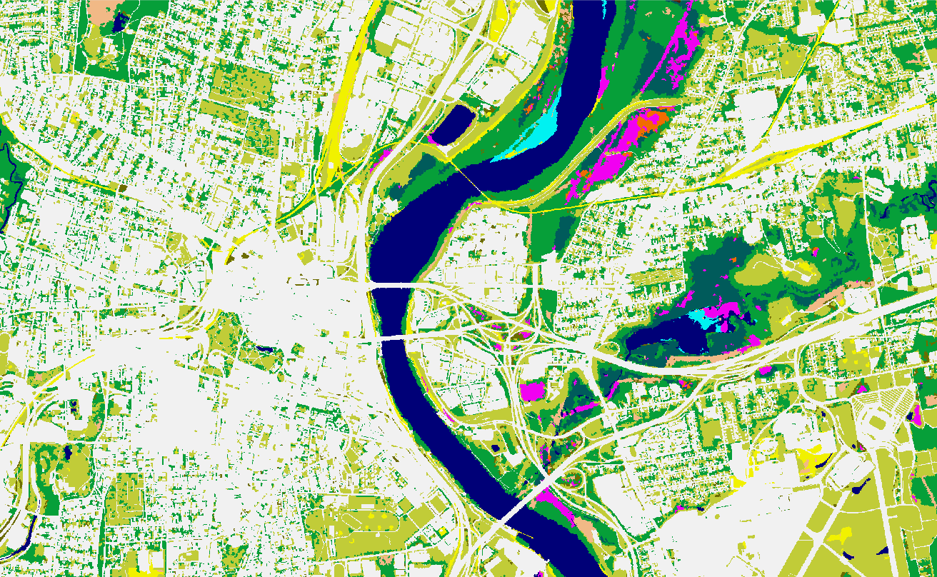
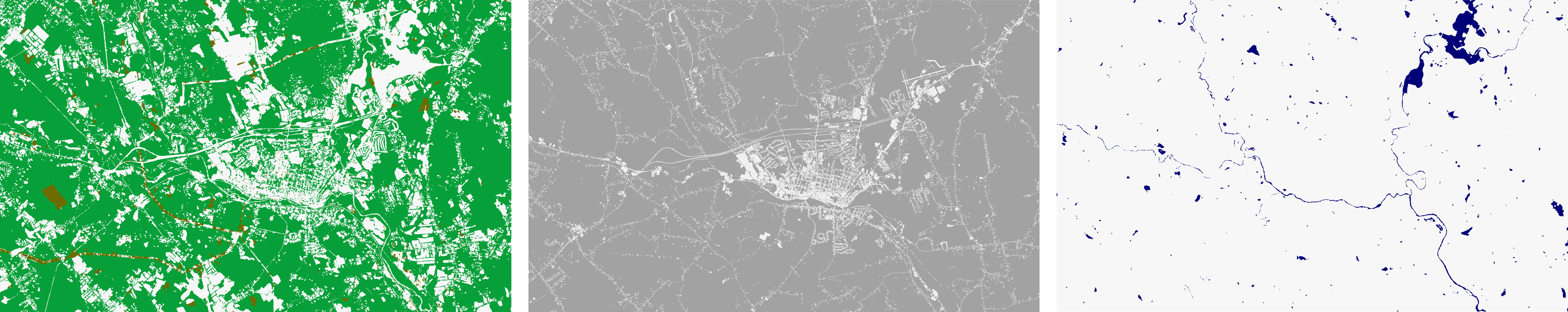
Land Cover and Change
Land Cover and Change
Server URL folder: https://cteco.uconn.edu/ctraster/rest/services/landcover
More about Changing Landscape with NLCD
Layer List
LAND COVER (30m pixels)
Each service contains multiple layers. The last layer in the list is the full land cover. Other layers contain a subset of classes that are redundant with the full land cover layer. When in doubt, use the full land cover layer.
Regional 1985 Land Cover (LandCover_1985_ANLCD) https://cteco.uconn.edu/ctmaps/rest/services/Landcover/LandCover_1985_ANLCD/MapServer
- Riparian Developed 1985 (Annual NLCD)
- Riparian Developed Open Space 1985 (Annual NLCD)
- Riparian Forest 1985 (Annual NLCD)
- Riparian Ag 1985 (Annual NLCD)
- Riparian Land Cover 1985 (Annual NLCD)
- Developed 1985 (Annual NLCD)
- Developed Open Space 1985 (Annual NLCD)
- Forest 1985 (Annual NLCD)
- Ag 1985 (Annual NLCD)
- Land Cover 1985 (Annual NLCD)
Regional 1995 Land Cover (LandCover_1995_ANLCD) https://cteco.uconn.edu/ctmaps/rest/services/Landcover/LandCover_1995_ANLCD/MapServer
- Developed 1995 (Annual NLCD)
- Developed Open Space 1995 (Annual NLCD)
- Forest 1995 (Annual NLCD)
- Ag 1995 (Annual NLCD)
- Land Cover 1995 (Annual NLCD)
Regional 2000 Land Cover (LandCover_2000_ANLCD) https://cteco.uconn.edu/ctmaps/rest/services/Landcover/LandCover_2000_ANLCD/MapServer
- Developed 2000 (Annual NLCD)
- Developed Open Space 2000 (Annual NLCD)
- Forest 2000 (Annual NLCD)
- Ag 2000 (Annual NLCD)
- Land Cover 2000 (Annual NLCD)
Regional 2005 Land Cover (LandCover_2005_ANLCD) https://cteco.uconn.edu/ctmaps/rest/services/Landcover/LandCover_2005_ANLCD/MapServer
- Developed 2005 (Annual NLCD)
- Developed Open Space 2005 (Annual NLCD)
- Forest 2005 (Annual NLCD)
- Ag 2005 (Annual NLCD)
- Land Cover 2005 (Annual NLCD)
Regional 2010 Land Cover (LandCover_2010_ANLCD) https://cteco.uconn.edu/ctmaps/rest/services/Landcover/LandCover_2010_ANLCD/MapServer
- Developed 2010 (Annual NLCD)
- Developed Open Space 2010 (Annual NLCD)
- Forest 2010 (Annual NLCD)
- Ag 2010 (Annual NLCD)
- Land Cover 2010 (Annual NLCD)
Regional 2015 Land Cover (LandCover_2015_ANLCD) https://cteco.uconn.edu/ctmaps/rest/services/Landcover/LandCover_2015_ANLCD/MapServer
- Developed 2015 (Annual NLCD)
- Developed Open Space 2015 (Annual NLCD)
- Forest 2015 (Annual NLCD)
- Ag 2015 (Annual NLCD)
- Land Cover 2015 (Annual NLCD)
Regional 2020 Land Cover (LandCover_2020_ANLCD) https://cteco.uconn.edu/ctmaps/rest/services/Landcover/LandCover_2020_ANLCD/MapServer
- Developed 2020 (Annual NLCD)
- Developed Open Space 2020 (Annual NLCD)
- Forest 2020 (Annual NLCD
- Ag 2020 (Annual NLCD)
- Land Cover 2020 (Annual NLCD)
Regional 2023 Land Cover (LandCover_2023_ANLCD) https://cteco.uconn.edu/ctmaps/rest/services/Landcover/LandCover_2023_ANLCD/MapServer
- Riparian Developed 2023 (Annual NLCD)
- Riparian Developed Open Space 2023 (Annual NLCD)
- Riparian Forest 2023 (Annual NLCD)
- Riparian Ag 2023 (Annual NLCD)
- Riparian Land Cover 2023 (Annual NLCD)
- Developed 2023 (Annual NLCD)
- Developed Open Space 2023 (Annual NLCD)
- Forest 2023 (Annual NLCD)
- Ag 2023 (Annual NLCD)
- Land Cover 2023 (Annual NLCD)
CHANGING LANDSCAPE LAND COVER CHANGE
These services contain multiple layers. The change layers include both change and no change classes. The change classes only include only change classes.
Regional Land Cover Change To 1985-2023 (LandCoverChangeTo_1985_2023_ANLCD) https://cteco.uconn.edu/ctmaps/rest/services/Landcover/LandCoverChangeTo_1985_2023_ANLCD/MapServer
- 1985-2023 Riparian Change To (change classes only)
- 1985-2023 Riparian Change To
- 1985-2023 Change To (change classes only)
- 1985-2023 Change To
Regional Land Cover Change From 1985-2023 (LandCoverChangeFrom_1985_2023_ANLCD) https://cteco.uconn.edu/ctmaps/rest/services/Landcover/LandCoverChangeFrom_1985_2023_ANLCD/MapServer
- 1985-2023 Riparian Change From (change classes only)
- 1985-2023 Riparian Change From
- 1985-2023 Change From (change classes only)
- 1985-2023 Change From
CHANGING LANDSCAPE LANDCOVER SUMMARIZED BY BASIN and TOWN
This is a HUC12 watershed layer is watershed polygons with lots of land cover attributes for area and percent of land cover classes, change, and matching attributes for riparian area land cover. In the attributes, "a" stands for area in "acres," "p" stands for percent. If "buff" is next, it is a riparian area class. Buff is shorter for buffer of waterbodies and streams. Next is the class name which is straightforward and IS is impervious. Following in the year such as 1985, 1990, etc and change classes include "diff" for difference and then two years being compared, with the most recent first. For example, 0085 is change between 1985 and 2000.
Regional Land Cover Watershed Statistics (ByBasin) https://cteco.uconn.edu/ctmaps/rest/services/Landcover/ByBasin_1985_2023/MapServer
- HUC-12 basins
- LIS watershed mask
This is a town layer of all the municipalities that are partially or fully within the Long Island Sound watershed. The towns have lots of land cover attributes for area and percent of land cover classes, change, and matching attributes for riparian area land cover. In the attributes, "a" stands for area in "acres," "p" stands for percent. If "buff" is next, it is a riparian area class. Buff is shorter for buffer of waterbodies and streams. Next is the class name which is straightforward and IS is impervious. Following in the year such as 1985, 1990, etc and change classes include "diff" for difference and then two years being compared, with the most recent first. For example, 0085 is change between 1985 and 2000.
Regional Land Cover Town Statistics (ByTown) https://cteco.uconn.edu/ctmaps/rest/services/Landcover/ByTown_1985_2023/MapServer
- Towns
Impervious Surface
Impervious Surface
Server URL: https://cteco.uconn.edu/ctraster/rest/services/landcover
1985 Impervious Surface: https://cteco.uconn.edu/ctmaps/rest/services/Landcover/ImperviousSurface_1985_ANLCD/MapServer
2023 Impervious Surface: https://cteco.uconn.edu/ctmaps/rest/services/Landcover/ImperviousSurface_2023_ANLCD/MapServer
The impervious surface layer is created by USGS as part of the Annual National Land Cover Database (NLCD). The NLCD impervious surface output represents fractional surface area of a pixel that is considered impervious and provides a value from 0-100 for every pixel mapped as one of the 4 developed categories (see next section). The value is equal to the percent of impervious in that pixel. The percent impervious per basin is calculated by finding the average percent impervious value within a basin and then multiplying the percent by the basin area. So, impervious surface is its own separate layer, derived from land cover but not one of the NLCD land cover classes. For more information, visit the CT ECO Changing Landscape with NLCD page or the USGS Annual NLCD Fractional Impervious Surface page.
CT 2016 High Resolution Land Cover from the NOAA Coastal Change Analysis Program (C-CAP)
CT 2016 High Resolution Land Cover from the NOAA Coastal Change Analysis Program (C-CAP)
Server URL (map service): https://cteco.uconn.edu/ctraster/rest/services/landcover/CCAP_Landcover2016_1m/MapServer
More about the 2016 High Resolution Land Cover on CT ECO
Layer List
- CCAP Landcover 2016 1m (ct_2016_ccap_hires_landcover_20200915.tif)
CT 2021 High Resolution Forest Canopy, Water, Impervious from the NOAA Coastal Change Analysis Program (C-CAP)
CT 2021 High Resolution Forest Canopy, Water, Impervious from the NOAA Coastal Change Analysis Program (C-CAP)
Server URLs (map service): https://cteco.uconn.edu/ctraster/rest/services/landcover
Forest Canopy: https://cteco.uconn.edu/ctraster/rest/services/landcover/CCAP_LandcoverForestCanopy2021_1m/MapServer
Impervious: https://cteco.uconn.edu/ctraster/rest/services/landcover/CCAP_LandcoverImpervious2021_1m/MapServer
Water: https://cteco.uconn.edu/ctraster/rest/services/landcover/CCAP_LandcoverWater2021_1m/MapServer
Learn more about NOAA's C-CAP High-Resolution Land Cover layers.
CT Land Cover and Change
CT Land Cover and Change
Server URL (map service): https://cteco.uconn.edu/ctraster/rest/services/landcover
More about CT Land Cover

Layer List
CHANGING LANDSCAPE 30m LAND COVER
Each service contains multiple layers. The last layer is the full land cover. Other layers contain a subset of classes that are redundant with the full land cover layer. When in doubt, use the full land cover layer.
CT 1985 Land Cover (CTlandcover1985) Metadata
CT 2015 Land Cover (CTlandcover2015) Metadata
CHANGING LANDSCAPE LAND COVER CHANGE
These services contain two layers. One includes both change and no change classes (called All Classes) and one includes only change classes (called Change classes only).
CT Land Cover Change To 1985-2015 (CTchangeTo1985_2015)
CT Land Cover Change From 1985-2015 (CTchangeFrom1985_2015)
CHANGING LANDSCAPE LANDCOVER SUMMARIZED BY TOWN
This is a Connecticut town layer with an attribute for area and percent of each land cover class including change. The layers in the service (Forest, Forest Change, Ag. Field, Ag. Field Change, Developed, Developed Change, Turf and Grass, Turf and Grass Change) have been symbolized using the appropriate attribute. The Town Stats layer is an outline and includes all attributes. In the attributes, "a" stands for "acres," "p" stands for percent, the year is either 1985, 2015, or 1985-2015 change "8515." Class numbers are listed on the classes page. For example, the attribute a1985_1 is acres in 1985 of class 1, developed.
CT Land Cover Town Statistics (ByTown)
CT Forest Fragmentation
CT Forest Fragmentation
Server URL (map service): https://cteco.uconn.edu/ctraster/rest/services/landcover
More about Forest Fragmentation
Layer List
The forest fragmentation services contain two layers. The Forest Fragmentation layer includes all classes while the Core Forest layer is just the Core Forest classes.
CT 1985 Forest Fragmentation (CTforestfrag1985)
CT 2015 Forest Fragmentation (CTforestfrag2015)
Long Island Sound Watershed Land Cover and Change
Long Island Sound Watershed (LIS) Land Cover and Change
Server URL (map service): https://cteco.uconn.edu/ctraster/rest/services/landcover
More about Long Island Sound Watershed Land Cover
Layer List
CHANGING LANDSCAPE 30m LAND COVER
Each service contains multiple layers. The last layer is the full land cover. Other layers contain a subset of classes that are redundant with the full land cover layer. When in doubt, use the full land cover layer.
LIS 1985 Land Cover (LISlandcover1985)
LIS 1990 Land Cover (LISlandcover1990)
LIS 1995 Land Cover (LISlandcover1995)
LIS 2002 Land Cover (LISlandcover2002)
LIS 2006 Land Cover (LISlandcover2006)
LIS 2010 Land Cover (LISlandcover2010)
LIS 2015 Land Cover (LISlandcover2015)
CHANGING LANDSCAPE LAND COVER CHANGE
These services contain two layers. One includes change and no change classes (called All Classes) and one includes only change classes (called Change classes only).
LIS Land Cover Change To 1985-2015 (LISchangeTo1985_2015)
LIS Land Cover Change From 1985-2015 (LISchangeFrom1985_2015)
CHANGING LANDSCAPE LAND COVER SUMMARIZED BY HUC12 BASIN
This is a HUC12 watershed layer with an attribute for area and percent of each land cover class including change. The layers in the service (Forest, Forest Change, Ag. Field, Ag. Field Change, Developed, Developed Change, Turf and Grass, Turf and Grass Change) have been symbolized using the appropriate attribute. The Basin Stats layer is an outline and includes all attributes. In the attributes, "a" stands for "acres," "p" stands for percent, the year is either 1985, 2015, or 1985-2015 change "8515." Class numbers are listed on the classes page. For example, the attribute a1985_1 is acres in 1985 of class 1, developed.
The service also contains Percent Impervious layers where a land-cover based impervious estimate is included. Learn more.
LIS Land Cover Basin Statistics (ByBasin)
Long Island Sound Watershed Riparian Area Land Cover and Change
Long Island Sound Watershed (LIS) Riparian Area Land Cover and Change
Server URL (map service): https://cteco.uconn.edu/ctraster/rest/services/landcover
More about Riparian Land Cover
Layer List
LIS 1985 Riparian Area Land Cover (LIS_riparian_landcover1985)
LIS 2015 Riparian Area Land Cover (LIS_riparian_landcover2015)
LIS Riparian Area Land Cover Change 1985-2015 (LIS_riparian_change1985_2015)
LIS Riparian Area Boundary (LIS_riparian)
1997 Municipal and Private Open Space
1997 Municipal and Private Open Space
DEEP Server URL (feature service): https://services1.arcgis.com/FjPcSmEFuDYlIdKC/arcgis/rest/services/1997_Municipal_and_Private_Open_Space/FeatureServer/0
![]() RETIRED. Old CT ECO Server URL (map service): https://cteco.uconn.edu/ctmaps/rest/services/Open_Space/1997_Municipal_and_Private_Open_Space/MapServer
RETIRED. Old CT ECO Server URL (map service): https://cteco.uconn.edu/ctmaps/rest/services/Open_Space/1997_Municipal_and_Private_Open_Space/MapServer
Layer List
1997 Municipal and Private Open Space Data Guide | Resource Guide | Metadata
DEEP Property
DEEP Property
DEEP Server URL (feature service): https://services1.arcgis.com/FjPcSmEFuDYlIdKC/arcgis/rest/services/Connecticut_DEEP_Property/FeatureServer/0
![]() RETIRED. Old CT ECO Server URL (map service): https://cteco.uconn.edu/ctmaps/rest/services/Open_Space/DEEP_Property/MapServer
RETIRED. Old CT ECO Server URL (map service): https://cteco.uconn.edu/ctmaps/rest/services/Open_Space/DEEP_Property/MapServer
Layer List
DEEP Property Data Guide | Resource Guide | Metadata
DOT Scenic Land Strips
DOT Scenic Land Strips
Server URL (map service): https://cteco.uconn.edu/ctmaps/rest/services/Open_Space/DOT_Scenic_Land_Strips/MapServer
Layer List
DOT Scenic Land Strips Data Guide
Federal Open Space 1997
Federal Open Space 1997
Server URL (feature service): https://services1.arcgis.com/FjPcSmEFuDYlIdKC/ArcGIS/rest/services/Federal_Open_Space/FeatureServer
![]() RETIRED. Old CT ECO Server URL (map service): https://cteco.uconn.edu/ctmaps/rest/services/Open_Space/Federal_Open_Space_1997/MapServer
RETIRED. Old CT ECO Server URL (map service): https://cteco.uconn.edu/ctmaps/rest/services/Open_Space/Federal_Open_Space_1997/MapServer
Layer List
Federal Open Space 1997 Data Guide | Resource Guide | Metadata
Protected Open Space Mapping
Protected Open Space Mapping
DEEP Server URL (feature service): https://services1.arcgis.com/FjPcSmEFuDYlIdKC/ArcGIS/rest/services/2011_Protected_Open_Space_Mapping/FeatureServer
![]() RETIRED. Old CT ECO Server URL (map service): https://cteco.uconn.edu/ctmaps/rest/services/Open_Space/Protected_Open_Space_Mapping/MapServer
RETIRED. Old CT ECO Server URL (map service): https://cteco.uconn.edu/ctmaps/rest/services/Open_Space/Protected_Open_Space_Mapping/MapServer
Layer List
Protected Open Space Mapping Data Guide | Resource Guide | Metadata
Parcels for Protected Open Space Mapping
Parcels for Protected Open Space Mapping
DEEP Server URL (feature service): https://services1.arcgis.com/FjPcSmEFuDYlIdKC/ArcGIS/rest/services/Connecticut_Parcels_for_Protected_Open_Space_Mapping/FeatureServer
![]() RETIRED. Old CT ECO Server URL (map service): https://cteco.uconn.edu/ctmaps/rest/services/Open_Space/Parcels_for_Open_Space_Mapping/MapServer
RETIRED. Old CT ECO Server URL (map service): https://cteco.uconn.edu/ctmaps/rest/services/Open_Space/Parcels_for_Open_Space_Mapping/MapServer
Layer List
Protected Open Space Mapping Data Guide | Resource Guide | Metadata
CT Parcels (2023)
CT Parcels (2023 data collect)
This service is an aggregation of municipal parcels (both their geometry and attributes) collected by the CT GIS Office of the Office of Policy and Management in 2023. After collection, extensive GIS work standardized the municipal datasets into a single layer.
Server URL for feature service: https://services3.arcgis.com/3FL1kr7L4LvwA2Kb/ArcGIS/rest/services/Connecticut_State_Parcel_Layer_2023/FeatureServer/0
Layer List
CT Parcels More info on CT ECO | More info on the CT Geodata Portal
CT Parcels (2020)
CT Parcels (2020 data collect)
This service is an aggregation of municipal parcels collected by the CT GIS Office of the Office of Policy and Management in 2020.
Server URL for cached service: https://cteco.uconn.edu/ctmaps/rest/services/Parcels/Parcels_tiled/MapServer
Server URL for map service: https://cteco.uconn.edu/ctmaps/rest/services/Parcels/Parcels/MapServer
Server URL for feature service: https://cteco.uconn.edu/ctmaps/rest/services/Parcels/Parcels/FeatureServer
Layer List
CT Parcels Parcel Report (xls) | More info
An updated statewide parcel layer can be found on the CT Geodata Portal.
Parcels for Protected Open Space Mapping (2003-2010)
Parcels for Protected Open Space Mapping (2003-2010)
Server URL (feature service): https://services1.arcgis.com/FjPcSmEFuDYlIdKC/ArcGIS/rest/services/Connecticut_Parcels_for_Protected_Open_Space_Mapping/FeatureServer
Old CT ECO Server URL (map service): https://cteco.uconn.edu/ctmaps/rest/services/Open_Space/Parcels_for_Open_Space_Mapping/MapServer
Layer List
Protected Open Space Mapping Data Guide | Resource Guide | Metadata
Administrative Boundary Index
Administrative Boundary Index
DEEP Server URLs (feature service):
- Regional Councils of Government Index: https://services1.arcgis.com/FjPcSmEFuDYlIdKC/arcgis/rest/services/Connecticut_Planning_Region_Index/FeatureServer/0
- CT US Congress Districts: https://services1.arcgis.com/FjPcSmEFuDYlIdKC/arcgis/rest/services/Connecticut_US_Congress_Districts/FeatureServer/0
- CT Senate Districts: https://services1.arcgis.com/FjPcSmEFuDYlIdKC/arcgis/rest/services/Connecticut_Senate_Districts/FeatureServer/0
- CT House Districts: https://services1.arcgis.com/FjPcSmEFuDYlIdKC/arcgis/rest/services/Connecticut_House_Districts/FeatureServer/0
- CT Index: https://services1.arcgis.com/FjPcSmEFuDYlIdKC/arcgis/rest/services/Connecticut_County_Index/FeatureServer/0
CT DOT Server URLs (feature service):
- CT Towns: https://services1.arcgis.com/FCaUeJ5SOVtImake/arcgis/rest/services/CT_Municipalities/FeatureServer/0
![]() RETIRED. Old Server URL (map service): https://cteco.uconn.edu/ctmaps/rest/services/Political/Administrative_Boundary_Index/MapServer
RETIRED. Old Server URL (map service): https://cteco.uconn.edu/ctmaps/rest/services/Political/Administrative_Boundary_Index/MapServer
Layer List
USGS Topographic Quadrangle Index Metadata Metadata
Regional Councils of Government Index CT DEEP Open GIS Data Summary | Metadata
CT US Congress Districts CT DEEP Open GIS Data Summary | Metadata
CT Senate Districts CT DEEP Open GIS Data Summary
CT House Districts CT DEEP Open GIS Data Summary | Metadata
CT County Index CT DOT Open GIS Data Summary | Metadata
CT Town CT DOT Open GIS Data Summary | Metadata
Connecticut Towns
Connecticut Towns
DEEP Server URL (feature service): https://services1.arcgis.com/FCaUeJ5SOVtImake/arcgis/rest/services/CT_Municipalities/FeatureServer/0
![]() RETIRED. Old CT ECO Server URL (map service): https://cteco.uconn.edu/ctmaps/rest/services/Political/Connecticut_Towns/MapServer
RETIRED. Old CT ECO Server URL (map service): https://cteco.uconn.edu/ctmaps/rest/services/Political/Connecticut_Towns/MapServer
Layer List
Town Line Metadata
Town Polygon Metadata
Northeast US Boundaries
Northeast US Boundaries
DEEP Server URLs (feature service)
- Northeast States: https://services1.arcgis.com/FjPcSmEFuDYlIdKC/arcgis/rest/services/Northeastern_States_State_Boundary_Set/FeatureServer
- Northeast Counties: https://services1.arcgis.com/FjPcSmEFuDYlIdKC/arcgis/rest/services/Northeastern_States_County_Boundary_Set/FeatureServer
- Northeast Towns: https://services1.arcgis.com/FjPcSmEFuDYlIdKC/arcgis/rest/services/Northeastern_States_Town_Boundary_Set/FeatureServer
![]() RETIRED. Old Server URL (map service): https://cteco.uconn.edu/ctmaps/rest/services/Political/Northeast_US_Boundaries/MapServer
RETIRED. Old Server URL (map service): https://cteco.uconn.edu/ctmaps/rest/services/Political/Northeast_US_Boundaries/MapServer
Layer List
Northeast States
Northeast State Line Metadata
Northeast State Polygon Metadata
Northeast Counties
Northeast Towns
Northeast State Boundaries
Northeast US Boundary Index (also called Northeastern State Boundaries)
DEEP Server URL (feature service): https://services1.arcgis.com/FjPcSmEFuDYlIdKC/arcgis/rest/services/Northeastern_States_State_Boundary_Set/FeatureServer
![]() RETIRED. Old Server URL: https://cteco.uconn.edu/ctmaps/rest/services/Political/Northeast_US_Boundary_Index/MapServer
RETIRED. Old Server URL: https://cteco.uconn.edu/ctmaps/rest/services/Political/Northeast_US_Boundary_Index/MapServer
Layer List
Northeast State Line Metadata
Northeast State Polygon Metadata
All Soils
All Soils
CT DEEP Server URL (feature service): https://services1.arcgis.com/FjPcSmEFuDYlIdKC/arcgis/rest/services/Soils_All_Soils/FeatureServer/0
![]() RETIRED. OLD CT ECO Server URL (map service): https://cteco.uconn.edu/ctmaps/rest/services/Soils/Soils/MapServer
RETIRED. OLD CT ECO Server URL (map service): https://cteco.uconn.edu/ctmaps/rest/services/Soils/Soils/MapServer
Layer List
Farmland Soils
Farmland Soils
DEEP Server URL (feature service): https://services1.arcgis.com/FjPcSmEFuDYlIdKC/arcgis/rest/services/Soils_Farmland_Classification/FeatureServer/
![]() RETIRED. Old CT ECO Server URL (map service): https://cteco.uconn.edu/ctmaps/rest/services/Soils/Farmland_Soils/MapServer
RETIRED. Old CT ECO Server URL (map service): https://cteco.uconn.edu/ctmaps/rest/services/Soils/Farmland_Soils/MapServer
Layer List
Hydric Soils
Hydric Soils Rating
DEEP Server URL (feature service): https://services1.arcgis.com/FjPcSmEFuDYlIdKC/ArcGIS/rest/services/Soils_Hydric_Rating/FeatureServer/0
![]() RETIRED. Old CT ECO Server URL (map service): https://cteco.uconn.edu/ctmaps/rest/services/Soils/Hydric_Soils/MapServer
RETIRED. Old CT ECO Server URL (map service): https://cteco.uconn.edu/ctmaps/rest/services/Soils/Hydric_Soils/MapServer
Layer List
Inland Wetland Soils
Inland Wetland Soils
DEEP Server URL (feature service): https://services1.arcgis.com/FjPcSmEFuDYlIdKC/arcgis/rest/services/Soils_Inland_Wetland/FeatureServer/
![]() RETIRED. Old CT ECO Server URL (map service): https://cteco.uconn.edu/ctmaps/rest/services/Soils/Inland_Wetland_Soils/MapServer
RETIRED. Old CT ECO Server URL (map service): https://cteco.uconn.edu/ctmaps/rest/services/Soils/Inland_Wetland_Soils/MapServer
Layer List
Potential for Subsurface Disposal Systems
Potential for Subsurface Disposal Systems
DEEP Server URL (feature service): https://services1.arcgis.com/FjPcSmEFuDYlIdKC/arcgis/rest/services/Soils_Subsurface_Sewage_Disposal_Systems/FeatureServer/
![]() RETIRED. Old CT ECO Server URL (map service): https://cteco.uconn.edu/ctmaps/rest/services/Soils/Potential_for_Subsurface_Disposal_Systems/MapServer
RETIRED. Old CT ECO Server URL (map service): https://cteco.uconn.edu/ctmaps/rest/services/Soils/Potential_for_Subsurface_Disposal_Systems/MapServer
Layer List
Potential for Subsurface Disposal Systems More Info | Metadata
Soils Drainage Class
Soils Drainage Class
DEEP Server URL (feature service): https://services1.arcgis.com/FjPcSmEFuDYlIdKC/arcgis/rest/services/Soils_Drainage_Class/FeatureServer
updated on CT ECO December 2023
Layer List
Soil Flooding Class
Soil Flooding Class
Please use FEMA National Flood Hazard Layers (NFHL) for flooding related layers https://hazards.fema.gov/gis/nfhl/rest/services/public/NFHL/MapServer
Learn more about the layers on the FEMA NFHL website.
![]() RETIRED. Old CT ECO Server URL (map service): https://cteco.uconn.edu/ctmaps/rest/services/Soils/Soil_Flooding_Class/MapServer
RETIRED. Old CT ECO Server URL (map service): https://cteco.uconn.edu/ctmaps/rest/services/Soils/Soil_Flooding_Class/MapServer
Soil Parent Material
Soil Parent Material
DEEP Server URL (feature service): https://services1.arcgis.com/FjPcSmEFuDYlIdKC/arcgis/rest/services/Soils_Parent_Material_Name/FeatureServer/
![]() RETIRED. Old CT ECO Server URL (map service): https://cteco.uconn.edu/ctmaps/rest/services/Soils/Soil_Parent_Material/MapServer
RETIRED. Old CT ECO Server URL (map service): https://cteco.uconn.edu/ctmaps/rest/services/Soils/Soil_Parent_Material/MapServer
Layer List
Basins
Basins
DEEP Server URL (feature service): https://services1.arcgis.com/FjPcSmEFuDYlIdKC/ArcGIS/rest/services/Drainage_Basin_Set/FeatureServer
![]() RETIRED. Old CT ECO Server URL (map service): https://cteco.uconn.edu/ctmaps/rest/services/Watersheds/Basins/MapServer
RETIRED. Old CT ECO Server URL (map service): https://cteco.uconn.edu/ctmaps/rest/services/Watersheds/Basins/MapServer
Layer List
Basins Data Guide | Line Metadata | Polygon Metadata | Direction Metadata
Visit Watersheds Explained for more information about these watersheds and others on CT ECO.
Local Basins
Local Basins
DEEP Server URL (feature service): https://services1.arcgis.com/FjPcSmEFuDYlIdKC/ArcGIS/rest/services/Local_Drainage_Basin_Set/FeatureServer
![]() RETIRED. Old CT ECO Server URL (map service): https://cteco.uconn.edu/ctmaps/rest/services/Watersheds/Local_Basins/MapServer
RETIRED. Old CT ECO Server URL (map service): https://cteco.uconn.edu/ctmaps/rest/services/Watersheds/Local_Basins/MapServer
Layer List
Local Basins Data Guide | Line Metadata | Polygon Metadata | Direction Metadata
Visit Watersheds Explained for more information about these watersheds and others on CT ECO.
Subregional Basins
Subregional Basins
DEEP Server URL (feature service):https://services1.arcgis.com/FjPcSmEFuDYlIdKC/ArcGIS/rest/services/Connecticut_Subregional_Drainage_Basin/FeatureServer
![]() RETIRED. Old CT ECO Server URL (map service): https://cteco.uconn.edu/ctmaps/rest/services/Watersheds/Subregional_Basins/MapServer
RETIRED. Old CT ECO Server URL (map service): https://cteco.uconn.edu/ctmaps/rest/services/Watersheds/Subregional_Basins/MapServer
Layer List
Subregional Basins Data Guide | Line Metadata | Polygon Metadata | Direction Metadata
Visit Watersheds Explained for more information about these watersheds and others on CT ECO.
Regional Basins
Regional Basins
DEEP Server URL (feature service): https://services1.arcgis.com/FjPcSmEFuDYlIdKC/ArcGIS/rest/services/Regional_Drainage_Basin_Set/FeatureServer
![]() RETIRED. Old CT ECO Server URL (map service): https://cteco.uconn.edu/ctmaps/rest/services/Watersheds/Regional_Basins/MapServer
RETIRED. Old CT ECO Server URL (map service): https://cteco.uconn.edu/ctmaps/rest/services/Watersheds/Regional_Basins/MapServer
Layer List
Regional Basins Data Guide | Line Metadata | Polygon Metadata
Visit Watersheds Explained for more information about these watersheds and others on CT ECO.
Major Basins
Major Basins
DEEP Server URL (feature service): https://services1.arcgis.com/FjPcSmEFuDYlIdKC/ArcGIS/rest/services/Major_Drainage_Basin_Set/FeatureServer
![]() RETIRED. Old CT ECO Server URL (map service): https://cteco.uconn.edu/ctmaps/rest/services/Watersheds/Major_Basins/MapServer
RETIRED. Old CT ECO Server URL (map service): https://cteco.uconn.edu/ctmaps/rest/services/Watersheds/Major_Basins/MapServer
Layer List
Major Basins Data Guide | Line Metadata | Polygon Metadata
Visit Watersheds Explained for more information about these watersheds and others on CT ECO.
Watershed Boundary Dataset Hydrologic Units (HUC)
Watershed Boundary Dataset Hydrologic Units (HUC)
DEEP Server URL: https://services1.arcgis.com/FjPcSmEFuDYlIdKC/arcgis/rest/services/Watershed_Boundary_Dataset/FeatureServer
![]() RETIRED. OLD CT ECO Server URLS
RETIRED. OLD CT ECO Server URLS
- Server URL HUC12 (map service): https://cteco.uconn.edu/ctmaps/rest/services/Watersheds/CT_Watershed_Boundary_Dataset_12_HU/MapServer
- Server URL HUC10 (map service): https://cteco.uconn.edu/ctmaps/rest/services/Watersheds/CT_Watershed_Boundary_Dataset_10_HU/MapServer
- Server URL HUC8 (map service): https://cteco.uconn.edu/ctmaps/rest/services/Watersheds/CT_Watershed_Boundary_Dataset_8_HU/MapServer
Layer List
Watershed Boundary Dataset Hydrologic Units Line Metadata | Polygon Metadata
- HUC Watershed Line
- HUC Watershed Poly
Attributes include HUC 8, HUC 10, and HUC 12 designations.
 HUC12 |
 HUC10 |
 HUC8 |
Visit Watersheds Explained for more information about these watersheds and others on CT ECO.
Aquifer Protection Areas
Aquifer Protection Areas
DEEP Server URL (feature service): https://services1.arcgis.com/FjPcSmEFuDYlIdKC/ArcGIS/rest/services/Aquifer_Protection_Areas/FeatureServer
![]() RETIRED. Old CT ECO Server URL (map service): https://cteco.uconn.edu/ctmaps/rest/services/Water_Resources/Aquifer_Protection_Areas/MapServer
RETIRED. Old CT ECO Server URL (map service): https://cteco.uconn.edu/ctmaps/rest/services/Water_Resources/Aquifer_Protection_Areas/MapServer
As of June 2021, the Aquifer Protection Area map service on CT ECO will not be updated. Use the Feature Server URL from DEEP for the most updated data.
Layer List
Aquifer Protection Area Data Guide | Resource Guide | Metadata
Assessed and Impaired Waterbodies 2022
Assessed and Impaired Waterbodies 2022
Server URL Impaired Waterbodies: https://services1.arcgis.com/FjPcSmEFuDYlIdKC/arcgis/rest/services/Impaired_Waterbodies_2022/FeatureServer
Server URL Assessed Waterbodies: https://services1.arcgis.com/FjPcSmEFuDYlIdKC/arcgis/rest/services/Assessed_Waterbody_305b_2022/FeatureServer
Layer List

CT 303(d) Impaired Waterbodies 2022
- Impaired River 2022
- Impaired Lake 2022
- Impaired Estuary 2022
CT 305(b) Assessed Waterbodies 2022
- Assessed River 2022
- Assessed Lake 2022
- Assessed Estuary 2022
Assessed and Impaired Waterbodies 2020
Assessed and Impaired Waterbodies 2020
DEEP Server URLs (feature service):
- Impaired: https://services1.arcgis.com/FjPcSmEFuDYlIdKC/arcgis/rest/services/Impaired_Waterbodies_2020/FeatureServer
- Assessed: https://services1.arcgis.com/FjPcSmEFuDYlIdKC/ArcGIS/rest/services/305b_Assessed_River_Lake_Estuary_Set/FeatureServer
Old Server URL (map service): https://cteco.uconn.edu/ctmaps/rest/services/Water_Resources/Assessed_and_Impaired_Waterbodies_2020/MapServer
Layer List
CT 303(d) Impaired Waterbodies 2020
- Impaired River 2020
- Impaired Lake 2020
- Impaired Estuary 2020
CT 305(b) Assessed Waterbodies 2020
Assessed and Impaired Waterbodies 2018
Assessed and Impaired Waterbodies 2018
DEEP Server URLs (feature service)
- Impaired: https://services1.arcgis.com/FjPcSmEFuDYlIdKC/arcgis/rest/services/Impaired_2018_River_Lake_Estuary_Set/FeatureServer
- Assessed: https://services1.arcgis.com/FjPcSmEFuDYlIdKC/ArcGIS/rest/services/305b_Assessed_2018_River_Lake_Estuary_Set/FeatureServer
Old Server URL (map service): https://cteco.uconn.edu/ctmaps/rest/services/Water_Resources/Assessed_and_Impaired_Waterbodies_2018/MapServer
Layer List
CT 303(d) Impaired Waterbodies 2018
- Impaired River 2018
- Impaired Lake 2018
- Impaired Estuary 2018
CT 305(b) Assessed Waterbodies 2018
Assessed and Impaired Waterbodies 2016
Assessed and Impaired Waterbodies 2016
DEEP Server URLs (feature service)
- Impaired: https://services1.arcgis.com/FjPcSmEFuDYlIdKC/arcgis/rest/services/Impaired_2016_River_Lake_Estuary_Set_NEW/FeatureServer
- Assessed: https://services1.arcgis.com/FjPcSmEFuDYlIdKC/ArcGIS/rest/services/305b_Assessed_2016_River_Lake_Estuary/FeatureServer
Old Server URL (map service): https://cteco.uconn.edu/ctmaps/rest/services/Water_Resources/Assessed_and_Impaired_Waterbodies_2016/MapServer
Layer List
CT 303(d) Impaired Waterbodies 2016
- Impaired River 2016
- Impaired Lake 2016
- Impaired Estuary 2016
CT 305(b) Assessed Waterbodies 2016
Assessed and Impaired Waterbodies 2014
Assessed and Impaired Waterbodies 2014
DEEP Server URLs (feature service)
- Impaired: https://services1.arcgis.com/FjPcSmEFuDYlIdKC/arcgis/rest/services/Impaired_2014_River_Lake_Estuary_Set/FeatureServer
- Assessed: https://services1.arcgis.com/FjPcSmEFuDYlIdKC/ArcGIS/rest/services/305b_Assessed_2014_River_Lake_Estuary/FeatureServer
Old Server URL: https://cteco.uconn.edu/ctmaps/rest/services/Water_Resources/Assessed_and_Impaired_Waterbodies_2014/MapServer
Layer List
CT 303(d) Impaired Waterbodies 2014
- Impaired River 2014
- Impaired Lake 2014
- Impaired Estuary 2014
CT 305(b) Assessed Waterbodies 2014
Assessed and Impaired Waterbodies 2012
Assessed and Impaired Waterbodies 2012
DEEP Server URLs (feature service)
- Impaired: https://services1.arcgis.com/FjPcSmEFuDYlIdKC/arcgis/rest/services/Impaired_2012_River_Lake_Estuary_Set/FeatureServer
- Assessed: https://services1.arcgis.com/FjPcSmEFuDYlIdKC/ArcGIS/rest/services/305b_Assessed_2012_River_Lake_Estuary/FeatureServer
Old Server URL (map service): https://cteco.uconn.edu/ctmaps/rest/services/Water_Resources/Assessed_and_Impaired_Waterbodies_2012/MapServer
Layer List
CT 303(d) Impaired Waterbodies 2012
- Impaired River 2012
- Impaired Lake 2012
- Impaired Estuary 2012
CT 305(b) Assessed Waterbodies 2012
Assessed and Impaired Waterbodies 2010
Assessed and Impaired Waterbodies 2010
DEEP Server URLs (feature service)
- Impaired: https://services1.arcgis.com/FjPcSmEFuDYlIdKC/arcgis/rest/services/Impaired_2010_River_Lake_Estuary_Set/FeatureServer
- Assessed: https://services1.arcgis.com/FjPcSmEFuDYlIdKC/ArcGIS/rest/services/305b_Assessed_2010_River_Lake_Estuary/FeatureServer
Old Server URL (map service): https://cteco.uconn.edu/ctmaps/rest/services/Water_Resources/Assessed_and_Impaired_Waterbodies_2010/MapServer
Layer List
CT 303(d) Impaired Waterbodies 2010
- Impaired River 2010
- Impaired Lake 2010
- Impaired Estuary 2010
CT 305(b) Assessed Waterbodies 2010
- Assessed River 2010 Metadata
- Assessed Lake 2010 Metadata
- Assessed Estuary 2010 Metadata
- Data Guide
Assessed and Impaired Waterbodies 2008
Assessed and Impaired Waterbodies 2008
DEEP Server URL (feature service):
- Impaired: https://services1.arcgis.com/FjPcSmEFuDYlIdKC/arcgis/rest/services/Impaired_2008_River_Lake_Estuary_Set/FeatureServer
- Assessed: https://services1.arcgis.com/FjPcSmEFuDYlIdKC/ArcGIS/rest/services/305b_Assessed_2008_River_Lake_Estuary/FeatureServer
Old Server URL (map service): https://cteco.uconn.edu/ctmaps/rest/services/Water_Resources/Assessed_and_Impaired_Waterbodies_2008/MapServer
Layer List
CT 303(d) Impaired Waterbodies 2008
- Impaired River 2008
- Impaired Lake 2008
- Impaired Estuary 2008
CT 305(b) Assessed Waterbodies 2008
- Assessed River 2008 Metadata
- Assessed Lake 2008 Metadata
- Assessed Estuary 2008 Metadata
- Data Guide
Assessed and Impaired Waterbodies 2006
Assessed and Impaired Waterbodies 2006
DEEP Server URLs (feature service):
- Impaired: https://services1.arcgis.com/FjPcSmEFuDYlIdKC/arcgis/rest/services/Impaired_2006_River_Lake_Estuary_Set/FeatureServer
- Assessed: https://services1.arcgis.com/FjPcSmEFuDYlIdKC/ArcGIS/rest/services/305b_Assessed_River_2006_River_Lake_Estuary/FeatureServer
Old Server URL (map service): https://cteco.uconn.edu/ctmaps/rest/services/Water_Resources/Assessed_and_Impaired_Waterbodies_2006/MapServer
Layer List
CT 303(d) Impaired Waterbodies 2006
- Impaired River 2006
- Impaired Lake 2006
- Impaired Estuary 2006
- Data Guide
CT 305(b) Assessed Waterbodies 2006
- Assessed River 2006 Metadata
- Assessed Lake 2006 Metadata
- Assessed Estuary 2006 Metadata
- Data Guide
Water Quality Classifications
Water Quality Classifications
DEEP Server URLs (feature service)
- Surface Water Quality: https://services1.arcgis.com/FjPcSmEFuDYlIdKC/ArcGIS/rest/services/Surface_Water_Quality_Classifications/FeatureServer/1
- Ground Water Quality: https://services1.arcgis.com/FjPcSmEFuDYlIdKC/arcgis/rest/services/Ground_Water_Classifications_Polygon/FeatureServer/0
Old Server URL (map service): https://cteco.uconn.edu/ctmaps/rest/services/Water_Resources/Water_Quality_Classifications/MapServer
Layer List
Surface Water Quality CT DEEP Open GIS Data Summary | Data Guide | Resource Guide
Ground Water Quality CT DEEP Open GIS Data Summary
- Ground Water Quality Well
- Ground Water Quality Metadata