![]() 3D Lidar Viewer |
3D Lidar Viewer | ![]() Advanced Map Viewer |
Advanced Map Viewer | ![]() Aerial Imagery Viewer |
Aerial Imagery Viewer | ![]() Air Photo Archive (UConn MAGIC) |
Air Photo Archive (UConn MAGIC) | ![]() Aquaculture Mapping Atlas |
Aquaculture Mapping Atlas | ![]() Coastal Hazards Viewer |
Coastal Hazards Viewer | ![]() Community Renewable Energy Siting Tool (CREST) |
Community Renewable Energy Siting Tool (CREST) | ![]() Elevation Viewer |
Elevation Viewer | ![]() Fish Community Data - Inland Waters (CT DEEP) |
Fish Community Data - Inland Waters (CT DEEP) | ![]() Fire: CT Wildland-Urban Interface/Intermix Viewer |
Fire: CT Wildland-Urban Interface/Intermix Viewer | ![]() Land Cover Viewer & Dashboards (w/NLCD) |
Land Cover Viewer & Dashboards (w/NLCD) | ![]() Land Cover Viewer (Original) |
Land Cover Viewer (Original) | ![]() Land Cover Viewer (High Resolution Land Cover, NOAA) |
Land Cover Viewer (High Resolution Land Cover, NOAA) | ![]() Long Island Sound Blue Plan Viewer |
Long Island Sound Blue Plan Viewer | ![]() MS4 Viewer |
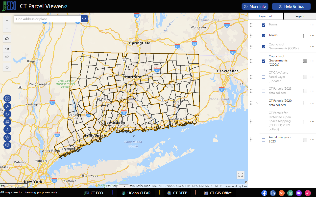
MS4 Viewer | ![]() Parcel Viewer (CT ECO) |
Parcel Viewer (CT ECO) | ![]() Sea Level Rise Effects on Roads and Marshes
Sea Level Rise Effects on Roads and Marshes
Advanced Map Viewerv2
The Advanced Map Viewerv2 is an interactive map viewer that provides the ability to view and combine many different data layers at once. It includes basic tools for viewing layers, address search, sharing, and more.
The original Advanced Map Viewer (version 1) is retired and is no longer updated. If the new viewer is missing functionality that you rely on, please let us know at clear@uconn.edu.

Aerial Imagery Viewerv2
The Aerial Imagery Viewerv2 is designed for viewing digital aerial imagery of Connecticut, certain regions in Connecticut, and along the Connecticut coastline and Connecticut River. It includes black and white, color, and infrared imagery acquired by regional, state and federal entities. Refer to CT Digital Aerial Datasets for descriptions of aerial imagery on CT ECO.
The original Aerial Imagery Viewer (version 1) is retired and is no longer updated. Please transition to using the Aerial Imagery Viewerv2. The new viewer is quite different from the original and please refer to the help to get started.

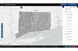
Elevation (Lidar) Viewerv2
The Elevation Viewerv2 includes statewide bare earth elevation from 2023 and from 2016 that can be displayed as hillshade, shaded relief, slope, or aspect. The viewer also contains reference layers such as municipal boundaries, parcels, aerial imagery, and more.
The original Elevation Viewer (version 1) is retired an is no longer updated. Please transition to the Elevation Viewerv2.
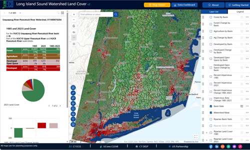
Long Island Sound Watershed Changing Landscape NLCD Land Cover
HUC12 Watershed Viewer and Dashboards
This tool present the Annual National Land Cover Database (NLCD) as both an interactive map viewer and data dashboards of the entire Long Island Sound watershed, including six states (VT, NH, MA, RI, CT, and NY). The tool includes nine dates of land cover, HUC 12 watershed land cover and land cover change statistics, riparian area land cover, and impervious surface.
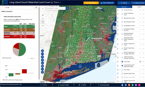
Long Island Sound Watershed Changing Landscape NLCD Land Cover
Town Viewer and Dashboards
This tool present the Annual National Land Cover Database (NLCD) as both an interactive map viewer and data dashboards for municipalities that are partially or fully within the Long Island Sound watershed. The tool includes nine dates of land cover, town land cover and land cover change statistics, riparian area land cover, and impervious surface.

CT Wildland-Urban Interface/Intermix Viewer
The CT Wildland-Urban Interface/Intermix Viewer was created by UConn CLEAR and the UConn Fire Department to provide an online interface to explore areas of increased fire risk across Connecticut. Don't miss the Viewer's sister Story Map, Wildfire in Connecticut: Changing Forest Health, Fire Ecology, and the Wildland-Urban Interface/Intermix.


Community Renewable Energy Siting Tool (CREST)
In May 2025, the Connecticut Department of Energy & Environmental Protection (DEEP) launched CREST to further Connecticut’s clean energy goals by enabling a more transparent and efficient siting and permitting process for large-scale renewable energy projects, while at the same time protecting Connecticut’s environmental and natural resources. It provides access to demographic, forestry, geology, land use, water, wildlife, electric utility interconnection, and other map layers. CREST can be used for informational purposes by municipal planners, solar developers, conservation organizations, members of the public, and others, but not as an agency determination or regulatory decision on solar suitability.

UConn MAGIC Air Photo Archive
The UConn MAGIC Air Photo Archive viewer is designed for finding historical aerial photographs that have been scanned. It is created and maintained by the University of Connecticut Map and Geographic Information Center (MAGIC), part of the UConn Libraries.

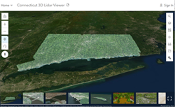
3D Lidar Viewer
The 3D Lidar Viewer is a proof of concept for publishing statewide colorized Lidar points in a 3D ArcGIS Online web scene. It was created with the help of Esri's Living Atlas Team. It includes Lidar points colored using imagery, elevation, intensity as well as points for buildings, bridges and more.
Long Island Sound Blue Plan Viewerv2
The purpose of the Long Island Sound Blue Plan is to identify and protect places of traditional use and ecological significance, and to minimize conflicts, now and in the future. This includes preserving a collective vision of Long Island Sound, and facilitating a transparent, science-based decision-making process. The Blue Plan Map Viewer contains data layers for the plan in a format for exploration.
The original Long Island Sound Blue Plan Viewer (version 1) is being retired and is no longer updated. Please transition to using the Long Island Sound Blue Plan Viewerv2.

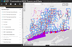
CT MS4 Viewer
The CT MS4 Viewer includes data layers that are helpful in registering for and complying with the 2017 CT MS4 General Permit.
CT Coastal Hazards Viewerv2
The Connecticut Coastal Hazards Viewer is designed to allow users access to several pertinent suites of data for coastal Connecticut. Presented here are data representing sea level rise, high-resolution coastal elevation, hurricane storm surge, coastal erosion, and environmental observations such as tides, water quality, waves and currents.

CT DEEP Fish Community Data - Inland Waters
CT DEEP and UConn CLEAR have collaborated to make Connecticut's freshwater fish community data (historical and current) available to the public. The Fish Community Data Application allows users to search DEEP fish community data for inland waters by town, waterbody, subregional basin, county, or fish species.

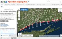
CT Aquaculture Mapping Atlas
The CT Aquaculture Mapping Atlas was developed by the University of Connecticut's Center for Land use Education and Research for the Connecticut Sea Grant Program, in collaboration with the Connecticut Department of Agriculture, Bureau of Aquaculture. It is intended to be a resource for industry managers and aquaculture enthusiasts. The Atlas includes up-to-date coastal and marine data layers including state and municipal shellfish beds, shellfish area markers, shellfish sampling stations, aquaculture gear areas, recreational and natural shellfish beds, areas licensed for seaweed production, shellfish classification areas, eelgrass beds, and more. Please note the Atlas is an outreach tool intended to be used for educational purposes only.
Sea Level Rise Effects on Roads and Marshes Viewerv2
To better understand how Connecticut’s coastal area marshes and roads may respond to sea level rise (SLR), Sea Level Affecting Marshes Model (SLAMM) was applied to Connecticut’s shoreline by Warren Pinnacle Consulting, Inc. This viewer displays the model’s results for Connecticut’s 21 largest marshes and all coastal area roads.

NOAA High Resolution Land Cover For Connecticut
Connecticut now has 1 meter resolution land cover courtesy of the NOAA Office of Coastal Management Coastal Change Analysis Program (C-CAP). The resolution means that each pixel covers a 1 meter square on the ground. Previous land covers are 30 meter squares - a big difference.
Original CT's Changing Landscape
Land Cover Viewer
The Connecticut Land Cover Viewer contains all dates of land cover as well as Change To, Change From, and Forest Fragmentation layers. It also has many layers where towns are colored based on a single land cover. Learn more about the layers in the Land Cover Viewer.
Original Lower Long Island Sound Watershed
Land Cover Viewer
The Long Island Sound Watershed Land Cover Viewer contains all dates of land cover as well as Change To, Change From, Riparian Area Land Cover, and Impervious Surface Estimate layers. It also has many layers where HUC 12 watersheds are colored based on a single land cover. Learn more about the layers in the Land Cover Viewer.
CT 2016 Imagery Viewer
The CT 2016 Viewer is designed for viewing the 2016, high resolution, 3 inch, 4 band digital aerial imagery for Connecticut. The viewer is designed to be used on all devices from mobile phones to large desktop screens. The viewer contains zoom, address search, locate me and share.
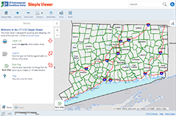
Simple Map Viewer (deprecated)
The Simple Map Viewer is being retired and is no longer updated. Please transition to using the Advanced Map Viewerv2. The new viewer is quite different from the original and please refer to the help to get started. If the new viewer is missing functionality that you rely on, please let us know at clear@uconn.edu.