ctmaps

Urgent: Migrate Select Services on ctmaps Server

A number of services on the CT ECO ctmaps server have been deprecated for some time and will be stopped in early June 2025. Most of the services are now available from the CT DEEP Open GIS Data site through a different link. Any connections to the impacted services in map viewers, desktop GIS, or other applications need to be updated to prevent future errors. This blog post includes:

  1. a list of CTECO ctmaps services that will be impacted and need to be migrated,
  2. a list of CT ECO ctmaps services that are not impacted, and
  3. instructions about finding the appropriate connection link on the CT DEEP Open GIS Data site.

Please make necessary modifications as soon as possible to avoid disruptions. 

For questions or help, email clear@uconn.edu.

information icon  How to find service link on CT DEEP Open GIS Data

map services icon CT ECO ctmaps REST server

CT DEEP logo CT DEEP Open GIS Data

CT GIS Office logo CT Geodata Portal

map services icon CT ECO ctraster REST server (not impacted)

Services to Migrate NOW

CT ECO SERVICE

DEEP OPEN DATA PAGE or NOTE

BASE MAP
CT_Base_Map Retired, not being replaced
CT_Bordering_States Northeastern States State Boundary Set
Transportation Connecticut Airports
Connecticut Airports FAA
Connecticut Railroads
Routes (Recommended: CTDOT Roadways)
BIOSCIENCE
Critical_Habitat Critical Habitats
CT_NWI_Wetland_Functions_2010 currently under review, check back
DEEP_FreshwaterFish DEEP Fisheries Stream Survey Points
Natural_Diversity_Database_Areas Natural Diversity Database
Tidal_Wetlands_1970s Tidal Wetlands 1970s
Tidal_Wetlands_1990s Tidal Wetlands 1990s
COASTAL
BluePlan_HU_FishShellfish Service is not impacted but consider using Dept. of Ag  CT Shellfish service
CT_Coastal_Managment_Areas Coastal Area and Boundary Polygon
CT_Hurricane_Evacuation_Zones_2014  currently under review, check back
CT_Hurricane_Surge_Inundation_2012 CT Hurricane Surge Inundation
CTCoastalMaintainedChannels currently under review, check back
Eelgrass_Beds_2002_2012 Eelgrass Beds 2002 Set
Eelgrass Beds 2006 Set
Eelgrass Beds 2009 Set
Eelgrass Beds 2012 Polygon
Eelgrass_Beds_2002_2017 Eelgrass Beds 2017 Polygon (Also contains 2002, 2006, 2009, and 2012 linked above)
LISBathymetry 
Bathymetric Contours in Meters for Long Island Sound
LIS_Environmental_Observation currently under review, check back
Sea_Level_Rise_Average_Monthly_Maximum currently under review, check back
Sea_Level_Rise_Mean_High_Water currently under review, check back
Shoreline_Change_Long_Term currently under review, check back
Shoreline_Change_Short_Term currently under review, check back
Shoreline_Change_Supplemental_Data currently under review, check back
ELEVATION
CT_Contours_2000 Service retired, download available
Lake_Bathymetry  Lake Bathymetry Contours
GEOLOGY
Bedrock Bedrock Geology
Bedrock_Terrane Bedrock Terrane
Erosion_Susceptibility  Erosion Susceptibility
Quaternary_Geology Quaternary Geology
Surficial_Aquifer_Potential  Surficial Aquifer Potential
Surficial_Aquifer_Texture Surficial Aquifer Texture
Surficial_Materials  Surficial Materials
HYDROGRAPHY
Hydrography CT Hydrography
Named__Waterbody  Named Waterbody
Waterbody Retired, not being replaced
OPEN SPACE
1997_Municipal_and_Private_Open_Space 1997 Municipal and Private Open Space
DEEP_Property DEEP Property
DOT_Scenic_Land_Strips  currently under review, check back
Federal_Open_Space_1997  Federal Open Space
Open_Space This is a grouping of services on this list
Parcels_for_Open_Space_Mapping  Although the service exists through CT DEEP, consider using updated parcels from the CT GIS Office.
Protected_Open_Space_Mapping 2011 Protected Open Space Mapping
POLITICAL
Administrative_Boundary_Index USGS Topographic Quadrangle Index currently under review, check back
Regional Councils of Governments (Consider CT Councils of Government or CT Planning Regions from the CT Geodata Portal)
US Congress Districts 2011-2020 (Consider CT US Congressional Districts on the CT Geodata Portal)
CT House Districts 2011-2020 (Consider CT House Districts on the CT Geodata Portal)
CT Senate Districts 2011-2020 (Consider CT Senate Districts from the CT Geodata Portal)
CT County Index (Consider CT Counties for the CT Geodata Portal)
Connecticut_Towns  CT DOT Municipalities (Consider CT Municipalities (with FIPS) from the CT Geodata Portal)
Northeast_US_Boundaries Northeastern State Boundaries (Also called Northeast US Boundaries Index)
Northeasters States County Boundaries
Northeastern States Town Boundaries
SOILS
Farmland_Soils  Soils Farmland Classification
Hydric_Soils Soils Hydric Rating
Inland_Wetland_Soils  Soils Inland Wetland
Potential_for_Subsurface_Disposal_Systems  Soils Subsurface Sewage Disposal Systems
Soil_Flooding_Class Retired, not being replaced
Soil_Parent_Material  Soils Parent Material Name
Soils Soils All Soils
WATER RESOURCES
Aquifer_Protection_Areas Aquifer Protection Areas
Assessed_and_Impaired_Waterbodies_2006 Impaired 2006 River Lake Estuary
Assessed_and_Impaired_Waterbodies_2008 Impaired 2008 River Lake Estuary
Assessed_and_Impaired_Waterbodies_2010  Impaired 2010 River Lake Estuary
Assessed_and_Impaired_Waterbodies_2012  Impaired 2012 River Lake Estuary
Assessed_and_Impaired_Waterbodies_2014 Impaired 2014 River Lake Estuary
Assessed_and_Impaired_Waterbodies_2016 Impaired 2016 River Lake Estuary
Assessed_and_Impaired_Waterbodies_2018 Impaired 2018 River Lake Estuary
Assessed_and_Impaired_Waterbodies_2020 Impaired 2020 River Lake Estuary
Water_Quality_Classifications Surface Water Quality Classifications
Ground Water Classifications
WATERSHEDS
CT_Watershed_Boundary_Dataset_8_HU currently under review, check back
CT_Watershed_Boundary_Dataset_10_HU currently under review, check back
CT_Watershed_Boundary_Dataset_12_HU currently under review, check back
Basins Drainage Basin Set
Local_Basins Local Drainage Basin Set
Subregional_Basins Subregional Drainage Basin Set
Regional_Basins  Regional Drainage Basin Set
Major_Basins Major Drainage Basin Set

How to find service link

The following instructions assume some familiarity with connecting to services in desktop or online GIS or other related software. The instructions are designed for those who are currently connected to CT ECO ctmaps services that are at end of life and need to be updated with CT DEEP services.

  1. Use the links in the table above to locate the data layer About page on the CT DEEP Open GIS Data.
  2. Add service graphic
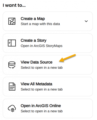
On the lower right side of the page, under the I want to... heading, find View Data Source.
  3. View Data Source opens the REST URL for the service which is also the connection link.
    1. Choice 1: Use full service with multiple layers. The full service link can be used for connection. Sometimes it is one layer and sometimes many. Adding the full service can be convenient but also has may result in limited ability to customize layers within the application. The service link ends in the words FeatureServer or MapServer and does NOT end in a number.
    2. Choice 2: Add single layer. Each layer can be added individually by clicking on it in the Layers: list of the REST URL. Layers are numbered starting with 0 (usually). Clicking on the layer opens its own URL which ends in a slash and then number.

Using Bedrock Geology as an example

  1. Open the CT DEEP GIS Open Data About page for Bedrock Geology.
  2. Find the I want to... options and the View Data Source link in the lower right side of the page. The link opens the REST page.
  3. Notice that there are two layers under the Layers: heading - Bedrock Geology Contacts (0) and Bedrock Geology (1).
  4. To follow Choice 1: Add full service with multiple layers, copy the link that ends in FeatureServer to connect to the full service (both layers).
    https://services1.arcgis.com/FjPcSmEFuDYlIdKC/arcgis/rest/services/Connecticut_Bedrock_Geology/FeatureServer
  5. To follow Choice 2: Add single layer, click on one of the layers, such as Bedrock Geology (1). The link is now for the single layer and ends in a number, /1. Copy the link to connect to the single layer.
    https://services1.arcgis.com/FjPcSmEFuDYlIdKC/ArcGIS/rest/services/Connecticut_Bedrock_Geology/FeatureServer/1